- Remove Granvin, frå 2020 del av nye Voss herad filter Granvin, frå 2020 del av nye Voss herad
- Remove Øygarden, frå 2020 del av nye Øygarden kommune. filter Øygarden, frå 2020 del av nye Øygarden kommune.
- Remove Bedrock filter Bedrock

Lussand- geology
Hardangerfjorden kløyver Hordaland i to. Den etter måten rettlinja fjorden skjer seg liksom på skeive inn i landet. Ikkje som Sognefjorden og Nordfjord – dei krokar og buktar seg innover meir eller mindre vinkelrett på kysten. Hardangerfjordens utforming har røter 400 millionar år tilbake i tida, då den veike sona i fjellet, der isen seinare tok grådig for seg, vart danna. Denne sona stig på land ved Lussand.
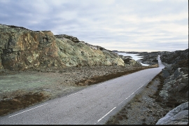
Turøyvegen
The earthquake was caused by movements along fault zones in the bedrock where the blocks of rock chafed against each other. In Devonian time, there were many big earthquakes that caused Hordaland to be broken up along fault zones. Some of these faults are visible along road cuts between Tofteøyna and Turøyna islands. Along the Hordaland coast, earthquakes still occur sometimes, though the quakes tend to be weaker.


