- Remove Article filter Article
- Remove Archaeology filter Archaeology
- Remove Communications filter Communications
- Remove Landscape filter Landscape
The forgotten saga
The saga regarding the settlement of Hordaland started off about 10,000 years ago. Most of this saga has been recorded in writing, not on paper, but on stone and on the earth in the forest and the marshes.
Farmers and Settlements
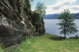
From 4,500 to 5,000 years ago most of Hordaland was a landscape of forest, right out to the coast and the islands. With our inner eye we can see old oak trees putting their stamp on the heat-loving deciduous forest.

Cultural Heritage and Cultural Landscapes
The development which culminated in the great west Norwegian clustered communities in the 18th and 19th centuries, such as we see at Havrå on Osterøy Island, actually first came into being in Viking times, with an incipient division of the farms into smaller units.

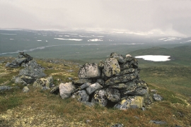
Hardangervidda – Crossing the Uplands
Slepa, the ancient “drove roads” across the plateau, date back to prehistoric times. Through the centuries cattle have been driven to the markets in the east; the people of Hardanger went on their trading journeys with tallow and salt to the mining town and silver mines of Kongsberg, and soldiers and other travellers also used these roads.
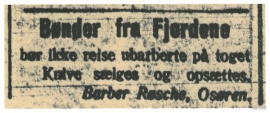
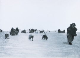
Farmers from the Fjords
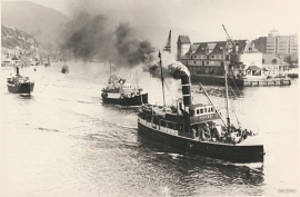
Eitt av dei store samferdsleprosjekta på Vestlandet mot slutten av 1800-talet var opninga av Nesttun-Osbanen i 1894 – ei oppbløming av lokalhandel, turisttrafikk og «landliggere».

From “Spearway” to National Highway
The Precambrian Era and Precambrian basement rocks
Almost nothing is as solid, unchangeable and stable as the Norwegian Precambrian basement rocks. Here, there are no volcanic eruptions or violent earthquakes that can cause natural catastrophes. But, it has not always been that way! There have been periods when glowing hot lava flowed over it or when large parts of the Precambrian basement have "taken a beating", both in Precambrian times and during the Caledonian mountain-building event.

Hordaland as high as the Himalayas- the Caledonian mountain chain
The Himalaya Mountain Chain is being formed by the Indian continental plate colliding w the Asian continent. This happens because the earth’s continental plates are constantly moving in relation to each other. Sometimes they crash together and form large collision zones or mountain chains. The collision between India and the Asian continent has created the world's highest mountain and thickest continental crust. But the creation of the Himalaya mountain chain is essentially just a repeat of what happened more than 400 million years ago when Western Norway and Greenland collided and formed the Caledonian mountain range. That mountain-building event caused quite dramatic changes in topography, climate and crustal thickness, and resulted in both volcanism and a lot of earthquake activity. In addition,

