- Remove Precipitation filter Precipitation
- Remove Fisheries filter Fisheries
- Remove Mineral resources filter Mineral resources
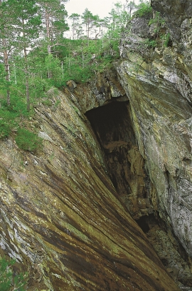
Varaldsøy- mining
There is still a lot of ore in the abandoned mines on Varaldsøy Island. If today's prices and availability of ore continue, it is doubtful whether the mines will resume operation. But, the pyrite is there, if the market should return. On Varaldsøy Island one finds at least nine mines and prospect pits, that for the most part date back to the latter part of the 1800s.

Bergen- Rain City
"With its strange situation (surrounded by high mountains), this city has the advantage of a beautiful port and considerable shipping, but also the disadvantage that once on land one cannot get to the city without great inconvenience. This is because the weather in the vicinity of these high mountains is extremely unpleasant and rainy. There has even evolved an expression that is always rains in Bergen, and we have not experienced anything to counteract this saying." (a quote by the Dutch professor Fabricius after a visit to Bergen in ca. 1780).

Ågotnes- crystals
Road cuts and blast areas are a joy to rock collectors, even if the disturbance to nature is ever so disfiguring. These are the best kinds of places to hunt for crystals, which otherwise are removed by weather and wind. In the Ågotnes area there are especially many beautiful crystals to be found.

Kvitingen
Few other places in Hordaland, or even the whole country, get as much rain as in the Samnanger mountains. The mountains here simply attract wetness. The weather station on Kvitingen has continuous measurements all the way back to 1900, and the measurements have documented several records for the county. The station is therefore much used as a reference for the rainfall in western Norway.

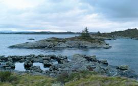
Goltasundet
For generations the land-seine was the most important tool for catching herring and mackerel, and therefore a suitable casting bay was worth its weight in gold. Goltasundet (the Golta sound) on Golta was such a place. Here the herring often drifted in and fantastic casts might be made here.

Skogsvåg
Kval i våg! Når det ropet gjekk, var det berre å få ut den kraftige kvalnota til å stengja vågen med, og så kunne veidinga ta til. I uminnelege tider har det vore drive kvalveiding i Skogsvågen.

Fosnstraumen
At the southern end of the bridge between Radøy and Fosnøy archaeologists found an unusual Stone Age settlement. There was a thick “cultural layer” here with the remains of the waste dumps of a hunting people. The place was called Kotedalen. Here they came, one group after the other, and settled for some weeks, some months, or maybe years before they went on, leaving the settlement deserted. Time after time it happened. At least 16 settlement phases have been identified, stretching over 5,500 years.

Toska
The peat bogs on Toska have been mined for peat since 1946, when the island got electricity. In this treeless coastal landscape, peat was the most important source of energy, and this took quite a toll on the bogs.

