- Remove Smallholdings filter Smallholdings
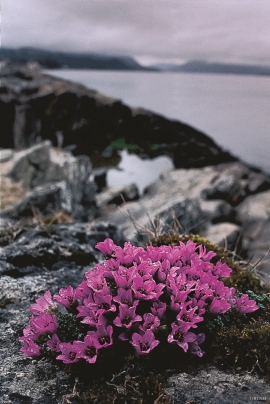
- Remove Plants by the sea filter Plants by the sea
- Remove Maritime environments filter Maritime environments
- Remove Faults filter Faults
- Remove Sunnhordland filter Sunnhordland


Fitjarøyane
If we study the group of islands south of Selbjørns Fjord from the air or on a sea map, we will notice that many of the islands are elongated and lie systematically in rows. The islands are divided by long sounds, for example Trollosen, Nuleia and Hjelmosen, which are oriented in a south-southeast to north-northwesterly direction.

Vernøya
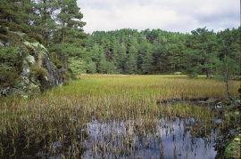
If you smell a foul smell out in nature, you mustn't immediately think that the reason is cloaca from houses or cabins. The reason can be an entirely natural process that occurs when plants are broken down under special conditions. When there is little oxygen available, hydrogen sulphide can be produced. This is a gas that seeps up from the earth and smells like rotten eggs.

Krokavatnet
On Sunday the 29th of January, 1989, at 17:38 o'clock, Etna shook. The earthquake, with its epicentre ca. 9 kilometres south of Etne centre, had a strength of 4.2 on the Richters scale. This could be felt over large parts of West Land, especially in the areas around Åkra, Etne, Hardanger Fjord and Sauda Fjord. The earthquake was the largest that has ever been measured in Hordaland.


