- Remove Smallholdings filter Smallholdings
- Remove Mountain plants filter Mountain plants
- Remove Sunnhordland filter Sunnhordland
- Remove Faults filter Faults
- Remove Seabirds filter Seabirds


Fitjarøyane
If we study the group of islands south of Selbjørns Fjord from the air or on a sea map, we will notice that many of the islands are elongated and lie systematically in rows. The islands are divided by long sounds, for example Trollosen, Nuleia and Hjelmosen, which are oriented in a south-southeast to north-northwesterly direction.

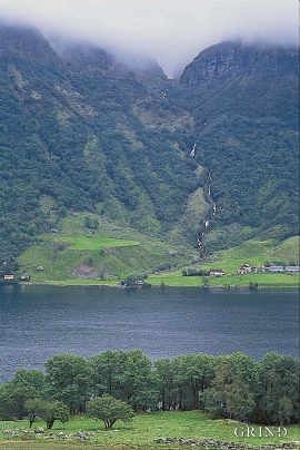
Grønafjellet
Mountain plants with their beautiful, colourful flowers are common in high altitude areas in Norway. On the coast there are not so many of them. But, here and there one nonetheless finds mountain plants, and this makes some coastal mountainsides a little bit different. Perhaps the growth on these mountainsides gives us a little glimpse of a distant past?

Fluøyane
The richest seabird localities in Bjørna Fjord are FLUØYANE, a group of small and medium-sized islets just east of the entrance to Våge. Here, we see many different nesting birds, but there is the danger that overgrowth will become an obstacle for nesting here in the future. On one of the islands, the environmental protection authority has promised to step in and help the birds.

Krokavatnet
On Sunday the 29th of January, 1989, at 17:38 o'clock, Etna shook. The earthquake, with its epicentre ca. 9 kilometres south of Etne centre, had a strength of 4.2 on the Richters scale. This could be felt over large parts of West Land, especially in the areas around Åkra, Etne, Hardanger Fjord and Sauda Fjord. The earthquake was the largest that has ever been measured in Hordaland.