- Remove Smallholdings filter Smallholdings
- Remove Maritime environments filter Maritime environments
- Remove Avalanches and rock falls filter Avalanches and rock falls
- Remove Churches filter Churches
- Remove Eidfjord filter Eidfjord
- Remove Hydro power filter Hydro power
- Remove Fitjar filter Fitjar
- Remove Igneous rocks filter Igneous rocks
- Remove Os, frå 2020 del av nye Bjørnafjorden kommune filter Os, frå 2020 del av nye Bjørnafjorden kommune


Fitjarøyane
If we study the group of islands south of Selbjørns Fjord from the air or on a sea map, we will notice that many of the islands are elongated and lie systematically in rows. The islands are divided by long sounds, for example Trollosen, Nuleia and Hjelmosen, which are oriented in a south-southeast to north-northwesterly direction.


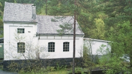
Gåssand
The 28th November 1914 was a day to remember for the Os inhabitants. This was the day they could turn the switch on the wall and have electric light in their houses. It was like opening the door on the future when the power station at Gåssand was put into operation.

Lyse chapel
The small white-painted chapel with the red brick tiled roof just south of the monastery ruins at Lyse was built in 1663 as a local chapel for the monastery estate, following the takeover of the property by the District Recorder (Stiftskriver) Niels Hanssøn Schmidt two years previously. The chapel, with its harmonic proportions, lies in the cultural landscape beside the grand monastery estate, witness to a time gone by. But even today, there is a tradition of high mass on the 2nd day of Ascension in Lyse Chapel.

Eidfjord church
The old stone church at Eidfjord has an open position on the terrace at Lægreid. In a diploma from 1310 it transpires that Torgeir on Sponheim donated a gift for the erection of the church in Eidfjord. Thus we can assume that the church was under construction at the time. The elements in the style confirm such a dating.

