- Remove Smallholdings filter Smallholdings
- Remove Music filter Music
- Remove Sunnhordland filter Sunnhordland
- Remove Faults filter Faults
- Remove Vegetation history filter Vegetation history


Fitjarøyane
If we study the group of islands south of Selbjørns Fjord from the air or on a sea map, we will notice that many of the islands are elongated and lie systematically in rows. The islands are divided by long sounds, for example Trollosen, Nuleia and Hjelmosen, which are oriented in a south-southeast to north-northwesterly direction.

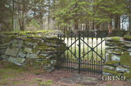
Grønafjellet
Mountain plants with their beautiful, colourful flowers are common in high altitude areas in Norway. On the coast there are not so many of them. But, here and there one nonetheless finds mountain plants, and this makes some coastal mountainsides a little bit different. Perhaps the growth on these mountainsides gives us a little glimpse of a distant past?

Tveitavatnet
It is difficult to imagine that a plant can grow at the same place for many thousands of years: Climate and local environment change. Different species grow up and die out. Nonetheless, some plants get established, but don't manage to spread into new areas, because the climate is at the edge of what they can tolerate. Great fen-sedge is just such a plant.

In Memory of Fartein Valen
“Fartein Valen is the key figure within newer Norwegian music. Not by way of being more popular than other younger composers, but because he aims at things higher, which he is fully confident of being able to reach since he commands all techniques. But there is a price to pay for reaching above the ordinary, and there is a price to pay for demanding more than the ordinary from the listeners. This is something Valen has experienced”.

Krokavatnet
On Sunday the 29th of January, 1989, at 17:38 o'clock, Etna shook. The earthquake, with its epicentre ca. 9 kilometres south of Etne centre, had a strength of 4.2 on the Richters scale. This could be felt over large parts of West Land, especially in the areas around Åkra, Etne, Hardanger Fjord and Sauda Fjord. The earthquake was the largest that has ever been measured in Hordaland.