- Remove Small landforms filter Small landforms
- Remove Middle age filter Middle age
- Remove Maritime environments filter Maritime environments
- Remove Livelihood and Craftsmanship filter Livelihood and Craftsmanship
- Remove Road constructions filter Road constructions
- Remove Wildlife filter Wildlife
- Remove Place filter Place
- Remove Introduced species filter Introduced species
- Remove Wetland filter Wetland
- Remove Settlements, Villages, Towns filter Settlements, Villages, Towns

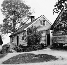
Arnatveit
On the farm of Arnatveit, high up on the slope above the highway, an old smokehouse remains standing in the courtyard of the main farm property, in the place of the old common courtyard. Today this farm lies at the outskirts of a large housing estate. Most of the farmland of the other farm properties has been sold to benefit the city’s need of sites for the new community of Arna.

Bryggen
In the 1300s Bergen was a trading centre of European dimension. The town is thought to have had around 7000 inhabitants and was the largest and most important in the country. In a European context it was an average size town. At this time the most tightly built town area was still mostly east of Vågen from Holmen in the north to Vågsbotn in the south. Already in medieval times, latest in the 1340s, this area was called Bryggen.

Kalandsvika
There is little to say about the opportunity for surveying from the bird observation tower in Kalandsvika: 155 different bird species have been sighted in the Kalands water shed. Take your binoculars and visit the tower in late spring - early summer or during the winter half of the year. If you are lucky, you might get to see a rare bird species.

Vågsbunnen
Vågsbotn was the name of the innermost part of the eastern part of town from Auta-almenning (today’s Vetrlidsalmenning), skirting the bottom of Vågen to Allehelgenskirken (All Saints’ Church) (at the present Allehelgensgate). In early medieval times Vågen reached almost all the way to Olavskirken (the Cathedral). It was a relatively wide bay inside the premonitory where Korskirken was built. The area was therefore much shorter than what is known as Vågsbunnen today.


Svåsand
Down by the fjord at Svåsand, close to the main highway, there is a long row of boathouses, one of the well-preserved, older boathouse locations along the Hardanger fjord. It is the farms at Svåsand that have their boathouses here, four main farms with origins far back in time.
Øpstad
The post house at Øpstad stands out in the landscape. An ochre yellow house with a loft and a white-painted house in Swiss style with ochre edgings, bears witness to a well preserved house from the 1800s, nearest neighbour to the beautiful old vicarage. In the Øpstad hamlet there was a post office for more than a hundred years, until the 1970s. Today it is possible to walk the old post road across the mountain to Strandvik, as part of “Den Stavangerske Postvei” (The post road to Stavanger).

Agastølen
Whoever wanders the mountain plateau will form time to time hit upon old mountain summer farms, with solid old stone sheds, half sunk into the ground; a building tradition that has roots into prehistoric times. When we have been satiated with untouched Nature, it is somewhat comforting to come upon the old mountain chalets - they represent a type of human encroachment that we not only accept, but appreciate. They arouse a feeling of recognition and are a distinct witness to how people in the rural communities have made use of even the most remote resources.

Langavassmyrane
The Ruff lek on Langvassmyrane is the only known phenomenon of its kind on Hardangervidda. Every year it attracts hens from the whole plateau. The marsh is also the richest wetland in the county. This green oasis is located in a rocky moraine landscape a few hours walking distance south of Dyranut.

Granvinsvassdraget
After the ice age, Granvin Fjord reached all the way up under Skjervsfjossen waterfall. Just a thousand years later, as a result of the rising of the land after the ice melted, this whole inner part of the fjord freed itself of the sea and became Granvinsvatnet lake. In spite of this rise in elevation, this waterway is still navigable for fish: Sea trout have wandered into Granvinsvatnet in more recent times and evolved to become freshwater trout. And salmon and sea trout made the journey 13 kilometres up the Storelvi river.

