- Remove Small landforms filter Small landforms
- Remove Lakes, rivers and river networks filter Lakes, rivers and river networks
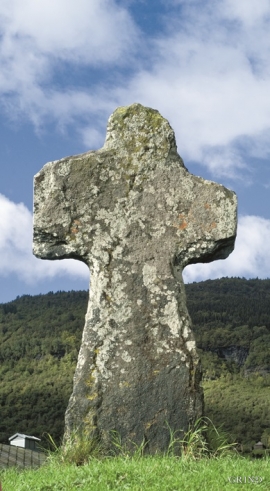
- Remove Voss, frå 2020 del av nye Voss herad. filter Voss, frå 2020 del av nye Voss herad.
- Remove Samnanger filter Samnanger
- Remove Middle age filter Middle age

Fossen Bratte
The steep drop by Fossen cliff has been the biggest challenge for those who wished to make a road over Kvamskogen through the years. Leave the car by the monument on the old road and take a walk down to the bend by the waterfall that Bergen-folk call "The bridal veil". Why is there a waterfall just here?

Frøland
Much rain, a steep drop and nearness to Bergen meant that the power-making potential of the Samnanger water system was exploited early. Samnanger was thus one of the first power-producing municipalities in western Norway. With its subsequent expansion and new power stations, about 400 gigawatts of electricity per hour were produced on average each year. This is enough to meet the energy needs of 25,000 households.


Bordalsgjelet
Deep down between the stone polished phyllite bedrock in Bordalsgjelet canyon, there is a cascading river. In close cooperation with hard polishing stones, the water has carved into the bedrock for thousands of years - and is still doing so today.

Finne
Peter Bonde, who owned Finne towards the end of the 1200s, had a jumping stag in his family emblem. This stag is the origin for the heraldic blazon of Voss. Peter Bonde and his descendants acquired possession of many farms and farm parts; the so-called Finne properties became some of the largest land properties in the country.