- Remove Modalen filter Modalen
- Remove Settlements, Villages, Towns filter Settlements, Villages, Towns
- Remove Stord filter Stord
- Remove Landscape filter Landscape

Mostraumen
Until 1743 the people from Modal had to wait for a flood in MOSTRAUMEN before they could draw their boats up the river current, and then row back across Lake Movatnet. But, that year the flood opened a free passageway all the way to Mo. Hordaland had gained a new tidal waterway.

Nedre Helland- skred
Many still remember when the avalanche struck Nedre Helland, on the 14th of August, 1953 14:30 o'clock. All of the buildings at one of the farms and the main house on the neighbouring farm were destroyed. The one woman who was inside a building escaped, frightened but unharmed. The same with the others who lived at Nedre Helland; everyone was a safe distance from the avalanche.

Nottveit
In one of the frame-built haysheds at Nottveit, at holding No. 3, we discover that several of the staves have a medieval look, with large dimensions and carefully rounded edges. According to tradition, it was the farms Nottveit and Mostraumen that supplied the timber for the stave church at Mo, and it is not unlikely that these farms received the old timber in return when the new church was erected there in 1593.

Otterstad
Tthe Otterstad farms lie in the innermost part of Mofjorden, on the northwest side of the river. The row of stave-built boatsheds that belong to the farm were probably constructed a little after the middle of the 1800s. Both here and on the Mo side, the boatsheds were important storage places at the seashore; wood and other farm products intended for the town; corn and merchandise in return.


Huglo
The majority of Huglo is bare rock. A bit of dwarf pine forest is the only vegetation able to put down roots. Along the west- and east sides, to the contrary, the landscape is unusually green and lush. The reason lies both in the bedrock and in the ice that covered the area 12 000 years ago.

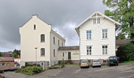
Leirvik- The prison
The district prison in Leirvik officially started operations in 1863. Together with the corresponding institutions in Voss and Bergen, this was Søndre Bergenhus’ part of the great Norwegian prison provisions in accordance with the Law on Prisons from 1857.

Leirvik- The trading post
Already in the Middle Ages the good harbour at Leirvik provided a connecting point. Here was a court of law, and a guesthouse was established here in the 1600s. But Leirvik never achieved the status of a trading post or a ship-loading place. In the census of 1865 parts of the farms Nordre Bjelland, Leirvik and Orninggård are mentioned as the “Coastal district of Lervig”. And the community grew around the old guesthouse location early in the 1800s.

Sagvåg
The pit saw on the property of the farm Valvatna, is the origin of the name Sagvåg. The sawmill is mentioned as early as 1564. The name of the place at that time was Fuglesalt, but soon there is only talk of Saugvog.

