- Remove Museums, nature conservation, cultural heritage filter Museums, nature conservation, cultural heritage
- Remove Arkeologi filter Arkeologi
- Remove Bedrock filter Bedrock
Earth and stone
"Humus" is a word with great meaning. It is the soil we live from, in addition to the resources we get from the ocean. This layer of earth - sometimes appearing as loose fertile organic matter; other places as scanty and acidic soil - is found in varying thicknesses over the bedrock. It is the result of 10,000 years of breakdown and erosion following the last ice age, and then several thousand years of cultivation in more recent times. The soil we can buy at the garden centre is a different product than the "natural" humus layer, formed of processes occurring far under the earth's surface. If you dig your spade into the soil where it has not been ploughed before, you will see that there is a big difference in colour, soil structure, moisture and stone content. We might say that the soil is fertile and easily worked some places, whereas other places folk might have given up trying to grow anything on their small patches of land, which then become overgrown with birch and thicket. Modern agriculture does not have room for small stumps between the piles of stone. Nowadays, machines do the job, and they require a lot of space and flat ground.


Ingahogg
At nearly 1000 metres over sea level, on the north side of INGAHOGG mountain, the remains of a soapstone quarry have been discovered. It is said, according to the Sagas, that Inga collected the big soapstone that lies in front of the Åkra Church from here.

Ølve- Mining
All in all there are ten known copper mines and two iron mines on the Ølve peninsula. Geologically, the nine mines on Varaldsøy Island also should be figured in. The industry began at Lilledal in 1642 wth the mining of iron ore. From Jernsmauget by Dyråsen, the iron ore was sent to the iron works in eastern Norway.


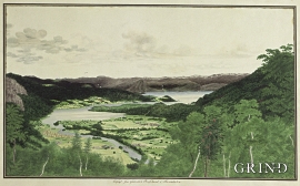
Lussand- geology
Hardangerfjorden kløyver Hordaland i to. Den etter måten rettlinja fjorden skjer seg liksom på skeive inn i landet. Ikkje som Sognefjorden og Nordfjord – dei krokar og buktar seg innover meir eller mindre vinkelrett på kysten. Hardangerfjordens utforming har røter 400 millionar år tilbake i tida, då den veike sona i fjellet, der isen seinare tok grådig for seg, vart danna. Denne sona stig på land ved Lussand.

