- Remove People and Society filter People and Society
- Remove Sunnhordland filter Sunnhordland
- Remove Bedrock filter Bedrock

Støle
High above the sea and the beach flats, on one of the wide terraces shaped by the sea and the ice, lies the farm Støle (Stødle). The Old Norse name of Studla is derived from studill “support, shelf”. As far back as Viking times Støle has been a chieftain’s farm, a good farm on the plains formed by the moraine masses.


Espevik
220 million years ago, glowing hot molten rock masses intruded into fractures in the earth's crust in the outer parts of Hordaland. Some of these are believed to have reached the surface and formed lava flows, which since have been eroded away by wind and weather. But, most of these flows solidified into diabase sills before they got to the surface.
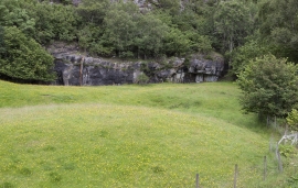
Dalskarvatnet–Dyvikvågen
Many of the fossils one finds on Stord are related to fossils of the same age found in North America. Scientists thinks this indicates that the bedrock on Stord was much nearer to America at that time than today.

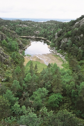
Kattnakken–Stovegolvet
The highest mountainous area on Stord, including Kattnakken, Midtfjellet and Stovegolvet, has more in common with the mountainous terrain on the mainland than in the low coastal landscape of Sunnhordland. The volcanic bedrock together with the erosive powers of nature has resulted in a unique plateau landscape.


