- Remove Article filter Article
- Remove Archaeology filter Archaeology
- Remove Livelihood and Craftsmanship filter Livelihood and Craftsmanship
- Remove Industry, Energy and Natural Resources filter Industry, Energy and Natural Resources
- Remove People and Society filter People and Society
- Remove Arkeologi filter Arkeologi
- Remove Communications filter Communications
Civil Servants in Small Societies 1650 – 1850
Demographic Growth – A Drive to Development
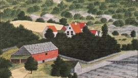
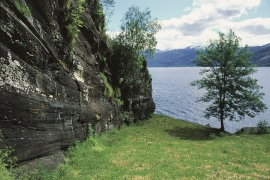
The cultural landscape or that part of it which is still green and inviting to the eye has been shaped by the farmers’ toil down through the generations. At one time almost all of us were farmers. We see that the crofting system faded away as emigration to the towns and to America relieved the pressure.
Earth and stone
"Humus" is a word with great meaning. It is the soil we live from, in addition to the resources we get from the ocean. This layer of earth - sometimes appearing as loose fertile organic matter; other places as scanty and acidic soil - is found in varying thicknesses over the bedrock. It is the result of 10,000 years of breakdown and erosion following the last ice age, and then several thousand years of cultivation in more recent times. The soil we can buy at the garden centre is a different product than the "natural" humus layer, formed of processes occurring far under the earth's surface. If you dig your spade into the soil where it has not been ploughed before, you will see that there is a big difference in colour, soil structure, moisture and stone content. We might say that the soil is fertile and easily worked some places, whereas other places folk might have given up trying to grow anything on their small patches of land, which then become overgrown with birch and thicket. Modern agriculture does not have room for small stumps between the piles of stone. Nowadays, machines do the job, and they require a lot of space and flat ground.
Farmers and Settlements
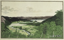
From 4,500 to 5,000 years ago most of Hordaland was a landscape of forest, right out to the coast and the islands. With our inner eye we can see old oak trees putting their stamp on the heat-loving deciduous forest.
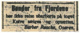
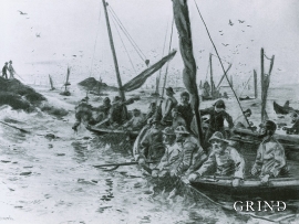
Farmers from the Fjords
Eitt av dei store samferdsleprosjekta på Vestlandet mot slutten av 1800-talet var opninga av Nesttun-Osbanen i 1894 – ei oppbløming av lokalhandel, turisttrafikk og «landliggere».

From “Spearway” to National Highway
Glaciers
Two of Norway's - and mainland Europe's - largest glaciers, in addition to a number of smaller glaciers, lie in Hordaland. This eternal ice is easily accessible, and easy to be enchanted with. A National Day parade goes to the top of the Hardanger glacier, and Folgefonna glacier has lift assistance at the summer ski centre in Jondal.
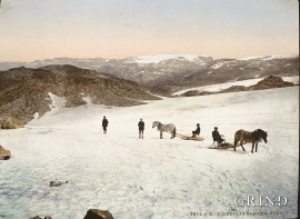
Hardangervidda – Crossing the Uplands
Slepa, the ancient “drove roads” across the plateau, date back to prehistoric times. Through the centuries cattle have been driven to the markets in the east; the people of Hardanger went on their trading journeys with tallow and salt to the mining town and silver mines of Kongsberg, and soldiers and other travellers also used these roads.

Hordaland as high as the Himalayas- the Caledonian mountain chain
The Himalaya Mountain Chain is being formed by the Indian continental plate colliding w the Asian continent. This happens because the earth’s continental plates are constantly moving in relation to each other. Sometimes they crash together and form large collision zones or mountain chains. The collision between India and the Asian continent has created the world's highest mountain and thickest continental crust. But the creation of the Himalaya mountain chain is essentially just a repeat of what happened more than 400 million years ago when Western Norway and Greenland collided and formed the Caledonian mountain range. That mountain-building event caused quite dramatic changes in topography, climate and crustal thickness, and resulted in both volcanism and a lot of earthquake activity. In addition,

