- Remove Quarns and mills filter Quarns and mills
- Remove Bergen filter Bergen
- Remove Urban environments filter Urban environments
- Remove Coniferous forests filter Coniferous forests

Bryggen
In the 1300s Bergen was a trading centre of European dimension. The town is thought to have had around 7000 inhabitants and was the largest and most important in the country. In a European context it was an average size town. At this time the most tightly built town area was still mostly east of Vågen from Holmen in the north to Vågsbotn in the south. Already in medieval times, latest in the 1340s, this area was called Bryggen.

Rådalen
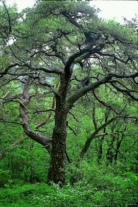
"...it would not be of any particular economical interest to support the planting of forest as the forest that can be cultivated will leave much to be desired in the way of growth potential." These words stem from the economist that at the end of the 1800s was sent to Stend to inspect the planned reforestation in person. The pioneer G.A.Wilson put the economist's words to shame. The spruce that was planted in Rådalen in the period 1867–1869 became a landmark. No other stand of forest in Scandinavia can boast more trees per unit area.

Sandviken
Close to the tunnel opening at Amalie Skrams vei in Ssandviken, there is a cultural monument of European dimensions; a rope making works that produced rope and fishing tackle for West and North Norway.

Strandsiden
During the 1300s Strandsiden changed from a rural area with a monastery to a pulsating trading centre with boathouses, storehouses and embankment.

Vågsbunnen
Vågsbotn was the name of the innermost part of the eastern part of town from Auta-almenning (today’s Vetrlidsalmenning), skirting the bottom of Vågen to Allehelgenskirken (All Saints’ Church) (at the present Allehelgensgate). In early medieval times Vågen reached almost all the way to Olavskirken (the Cathedral). It was a relatively wide bay inside the premonitory where Korskirken was built. The area was therefore much shorter than what is known as Vågsbunnen today.

