- Remove Smallholdings filter Smallholdings
- Remove Igneous rocks filter Igneous rocks
- Remove Defense filter Defense
- Remove Railroad filter Railroad


Bergensbanen
Already at the beginning of the 1870s demands were made that there had to be a railway connection between Bergen and East Norway. The first section between Bergen and Voss was finished in 1883. The route alternatives further on were many: Lærdal-Valdres, Aurland-Geiteryggen, Raundalen-Finse and Ulvik-Finse. Following a long dispute, an agreement was finally reached that the middle route alternative, Raundalen- Myrdal- Finse, was the best alternative. In 1894 the government passed a resolution that the Bergen railway should be built, but only the section Voss-Taugevatn. This was a political gamble in order to make the rest of the country participate in the plans. In 1898 it was approved that the railway be continued eastwards from Taugevatn to Oslo. This high mountain project was one of the most challenging railway projects in Europe. The Bergen railway was to be built across a mountain plateau without roads.

Bergensbanen- snow measurements
Opponents of the Bergen Railway used the snow argument for all it was worth. During the debate in Parliament before the decision about the route was reached in 1894, fears of snowfalls of over 20 metres were presented.


Espevik
220 million years ago, glowing hot molten rock masses intruded into fractures in the earth's crust in the outer parts of Hordaland. Some of these are believed to have reached the surface and formed lava flows, which since have been eroded away by wind and weather. But, most of these flows solidified into diabase sills before they got to the surface.
Finnås
At Flintaneset by Finnåsvika, in the centre of the municipality, we find the most beautiful and best preserved igneous rocks in western Norway. We must go to Hawaii or Island to find as fine structures as at Bømlo.

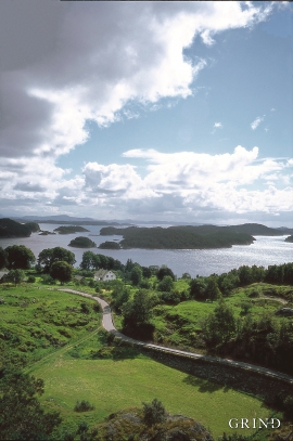
Fitjarøyane
If we study the group of islands south of Selbjørns Fjord from the air or on a sea map, we will notice that many of the islands are elongated and lie systematically in rows. The islands are divided by long sounds, for example Trollosen, Nuleia and Hjelmosen, which are oriented in a south-southeast to north-northwesterly direction.


