- Remove Smallholdings filter Smallholdings
- Remove Igneous rocks filter Igneous rocks
- Remove Defense filter Defense
- Remove Sediments filter Sediments


Eksingedalen- landscape
Eksingedalen alternates between wide, flat flood plains with good farmland, and narrow passages with waterfalls where the roads cling to the mountainsides. The alternations in the landscape are a result of the sculpturing work by glaciers over several ice ages, and the deposition of the glacial river deposits when the last glacier finally melted back.

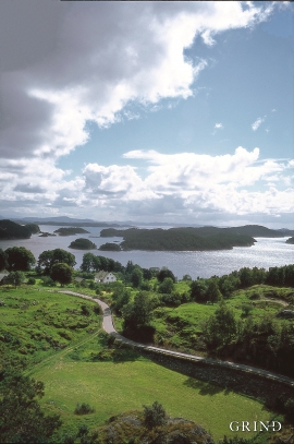
Espevik
220 million years ago, glowing hot molten rock masses intruded into fractures in the earth's crust in the outer parts of Hordaland. Some of these are believed to have reached the surface and formed lava flows, which since have been eroded away by wind and weather. But, most of these flows solidified into diabase sills before they got to the surface.
Finnås
At Flintaneset by Finnåsvika, in the centre of the municipality, we find the most beautiful and best preserved igneous rocks in western Norway. We must go to Hawaii or Island to find as fine structures as at Bømlo.

Fitjar- potatoes
The deep agricultural soils in Fitjar are found especially in the area between Lake Storavatnet and Breivika. The many stonewalls in the area reflect that the earth probably was full of stones and stone blocks. The stones that couldn't be dug out had also a function: they stored heat that helped to grow potatoes.

Fitjarøyane
If we study the group of islands south of Selbjørns Fjord from the air or on a sea map, we will notice that many of the islands are elongated and lie systematically in rows. The islands are divided by long sounds, for example Trollosen, Nuleia and Hjelmosen, which are oriented in a south-southeast to north-northwesterly direction.

Fjøsanger
Fjøsanger is known among ice age researchers from around the world. Under an excavation in 1975-77, geologists from the University of Bergen found layers from the last interglacial, ca. 115 000 to 130 000 years old.

