- Remove Boat- and shipyards filter Boat- and shipyards
- Remove Place filter Place
- Remove Igneous rocks filter Igneous rocks

Berge
Down by the fjord on the farm Berge in Tørvikbygd, is Stekkavika – a sheltered eastward facing harbour, protected against the fjord by headlands and rocks, even manifest in the name. Here is also a comprehensive milieu of coastal industry, with boathouses and sea-sheds that belong to the farms Berge, Heradstveit and Halleråker. Belonging to the farm Berge there is also a mill-house, circular saw, workshop for sloop building, and – a little further up into the woods – the old water-powered sash-saw.


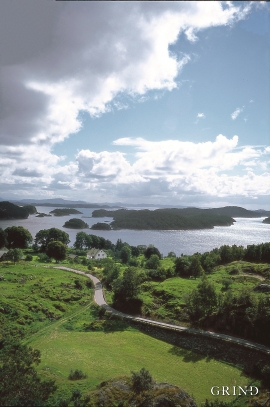
Espevik
220 million years ago, glowing hot molten rock masses intruded into fractures in the earth's crust in the outer parts of Hordaland. Some of these are believed to have reached the surface and formed lava flows, which since have been eroded away by wind and weather. But, most of these flows solidified into diabase sills before they got to the surface.
Finnås
At Flintaneset by Finnåsvika, in the centre of the municipality, we find the most beautiful and best preserved igneous rocks in western Norway. We must go to Hawaii or Island to find as fine structures as at Bømlo.

Fitjarøyane
If we study the group of islands south of Selbjørns Fjord from the air or on a sea map, we will notice that many of the islands are elongated and lie systematically in rows. The islands are divided by long sounds, for example Trollosen, Nuleia and Hjelmosen, which are oriented in a south-southeast to north-northwesterly direction.


Kattnakken–Stovegolvet
The highest mountainous area on Stord, including Kattnakken, Midtfjellet and Stovegolvet, has more in common with the mountainous terrain on the mainland than in the low coastal landscape of Sunnhordland. The volcanic bedrock together with the erosive powers of nature has resulted in a unique plateau landscape.

