- Remove Øygarden, frå 2020 del av nye Øygarden kommune. filter Øygarden, frå 2020 del av nye Øygarden kommune.
- Remove Basement rocks filter Basement rocks
- Remove Midthordland filter Midthordland
- Remove Hydro power filter Hydro power
- Remove Churches filter Churches
- Remove Askøy filter Askøy
- Remove Sund, frå 2020 del av nye Øygarden kommune filter Sund, frå 2020 del av nye Øygarden kommune
Strusshamn
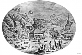
On the south side of Askøy, just west of Bergen, lies Strusshamn. The sheltered bay is one of the best harbours in Byfjorden, on the route south. At the time of the sailing ships the harbour could be full of vessels from Bergen and abroad, lying in wait for favourable wind. Old anchoring rings from 1687 bear witness to this. Strusshamn was a quarantine harbour for ships that came sailing in with the yellow pest flag flying.

Hjelmo
On the farm Hjelmo, furthest north in Øygarden, in the innermost part of a long bay, there is a fine boatshed collection with a church beside it. From times immemorial this has probably been the fish-shed location for these farm units and this was also the landing place for the churchgoers.

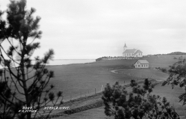
Herdla Church
A letter from the Pope Eugenius 3 in 1146 mentions St. Nikolaus church at Herdla. This church belonged under Munkeliv monastery, which was founded in Bergen by Øystein around 1110. The Herdla Church may stem from this time.

Golta- Gneiss
Over thousands of years, autumn storms and strong land-driving winds have cleaned the bare rocks of Golta. The waves can beat far in over land and make it dangerous to walk along the shoreline. When the storms have calmed, the results of their work comes into view.

Tyssøy
B.E.Bendixen, who has written about “The Churches in Søndre Bergenhus Amt”, believed even around 1900 that there was evidence at Tyssøy of the church or the chapel of the Holy Ludvig (Louis). Two large stone blocks had lain in the western wall of the church’s nave, and this wall showed a length of 16 meters in the terrain.

Toftestallen
The large coastal waves that crash down on the islands west in the sea gather their energy from storms and winds all the way out in the North Atlantic Ocean. The most common place of origin is nonetheless the North Sea. When these waves break over the skerries and islets along the shore, or on the rocky outermost islands, their energy is released. This takes the form of turbulence in the water and sea spray up on land. Can the enormous energy contained in the waves be exploited?


