- Remove Quarns and mills filter Quarns and mills
- Remove Thrust sheets filter Thrust sheets

Hamlagrø
The type of underlying rock can be decisive for how many different types of plants are found in an area. In the area around Hamlagrø-lake the diversity is especially obvious. The geological conditions change much here within a short distance.

Hereiane
At Hereiane on warm summer days one you can walk barefoot up the hill from the fjord all the way up to 400 metres elevation. The naked, furrowed bedrock often causes travellers who see it from the north side of the fjord to wonder. Why does it look like this, and why is there so little that grows here? It is a long way to the heavy metal industry in Ålvik and Odda, and there hasn’t been a forest fire in modern times.


Hårteigen
Hårteigen, «the grey signpost», as the name suggests, is a landmark for mountain hikers on the western plateau. The piece of mountain is also a monument for the mighty rock layers that once covered the entire plateau.

Kvamskogen
The different bedrock types that got shoved in over Hordaland in Cambro-Silurian times still remain, layer by layer, almost like a cake. But at Kvamskogen the cake has been turned upside down.

Kvernapollen
When the workers came to Kollsnes to start on the work with the landing for the gas terminal from the Troll field in the North Sea, they found the ruins of an old farm mill at Kvernapollen.
Kvernes
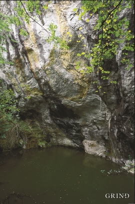
Håkons Hall, Domkirken Church, Bergen Børs Stock Exchange, Permanenten and other well known buildings in Bergen are decorated with soapstone from Øvre Kvernes. The quarry is a big hole in the mountainside by the cliff just east of the farm buildings.

Litlandsvatnet
Large quantities of nickel ore have been mined from Litlandsvatnet, between Lonevågen and Hosanger. The discovery was made in 1875. During the period of operation from 1882 to 1945, 4170 tonnes of pure nickel were extracted from 462 000 tonnes of ore, a large production by Norwegian standards.

Lussand- geology
Hardangerfjorden kløyver Hordaland i to. Den etter måten rettlinja fjorden skjer seg liksom på skeive inn i landet. Ikkje som Sognefjorden og Nordfjord – dei krokar og buktar seg innover meir eller mindre vinkelrett på kysten. Hardangerfjordens utforming har røter 400 millionar år tilbake i tida, då den veike sona i fjellet, der isen seinare tok grådig for seg, vart danna. Denne sona stig på land ved Lussand.

