- Remove Place filter Place
- Remove Coniferous forests filter Coniferous forests
- Remove Large landforms filter Large landforms

Kattnakken–Stovegolvet
The highest mountainous area on Stord, including Kattnakken, Midtfjellet and Stovegolvet, has more in common with the mountainous terrain on the mainland than in the low coastal landscape of Sunnhordland. The volcanic bedrock together with the erosive powers of nature has resulted in a unique plateau landscape.
Storsøya Island
On Storsøya Island, English ivy grows nearly everywhere. It creeps along the ground and climbs all the way to the top of the tree trunks. Together with holly, the trees of juniper, yew and an unusual pine forest keep the island green the whole year 'round.

Hopsfjellet
On June 2nd, 1992, a big forest fire broke out in Sveio. The fire started southeast of Hopsfjellet. In a strong wind the flames spread quickly northward. Houses on the other side of the highway were threatened, but escaped unscathed. The burned area, which is easily visible about a 5 minute's drive south from the tunnel at the triple- junction, was made into a nature reserve in 1998. The intention was to ensure that the re-establishment of plant- and animal life would take place without disturbance.

Ånuglo
Take a tour to Ånuglo on a warm summer's day. You can anchor up in Skipavågen and go exploring along the beach. Or, you can find giant holly trees and ivy inland on the island. If you take a trip to the small farms on the west side - one of which is still in operation - you can experience colourful flower meadows from a time most dream of, but few can still remember.

Hamlagrø
The type of underlying rock can be decisive for how many different types of plants are found in an area. In the area around Hamlagrø-lake the diversity is especially obvious. The geological conditions change much here within a short distance.

Tokagjelet
There is a sharp transition between the wide valley at Kvamskogen and the narrow Tokagjelet. The transition is no less dramatic when we come out of the crooked tunnels far down in the canyon, and the open Steinsdalen valley spreads out before us. The canyon both separates and joins together different epochs in western Norway's history.


Sandviksfjellet
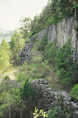
On Sandviksfjellet there are old boulders that have been made into mountains. The stones have been stretched out or squeezed together between huge slabs of rock, during slow, but powerfulprocesses of transport. This conglomerate shows, in quite a special way, the enormous powers that were active during the collision between Norway and Greenland over 400 million years ago.

Isdalen
The valley on the inside of the Svartediks dam, a five minutes' bus ride from Bergen centre, is often referred to by Bergen folk as Isdalen ("Ice Valley") - justifiably, since the area could have been described in textbooks for its ice-carved land forms. The glacier's polishing over ca. 40 ice ages has created a magnificient landscape. The original ice valley climbs up behind Ulriken at the end of Svartediket.

