- Remove Etne filter Etne
- Remove Os, frå 2020 del av nye Bjørnafjorden kommune filter Os, frå 2020 del av nye Bjørnafjorden kommune
- Remove Samnanger filter Samnanger
Søfteland
If you drive between Søfteland and Ulven on a clear spring morning, or an evening in late autumn, you are advised to be careful on the turns. The temperature on the road can fall to under 0 °C here long before other places in the municipality. On clear, still nights the earth's surface chills quite a bit. In exposed areas a layer of cold air develops very near the ground and the road surface can easily chill to below freezing.
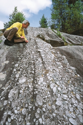
Ulven
In the region of Ulven phyllite occurs with Hordaland's youngest fossils, and a beautiful quartz conglomerate. The phyllite and conglomerate got squeezed into the bottom of an ancient oceanic crust, made of gabbro and greenstone, in the heart of the Caledonide mountain chain.


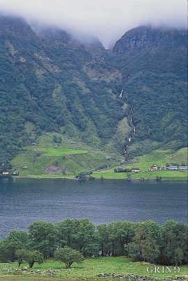
Ulvenvatnet
Lake Ulvenvatnet is thought to be the most species rich wetlands in the municipality. Despite this, the area is not protected, nor is it likely ever to be.

Skånevik- moraine
In Skånevik there are marks left from the ice edge that advanced during the thousand-year cold spell (Younger Dryas) that marked the end of the Ice Age roughly 11 500 years ago. The glacier first proceeded out into Åkra Fjordand and around Vannes and thereafter sent an arm in toward Skånevik. Here, the glacier lay down an end moraine up against the mountainside.

Krokavatnet
On Sunday the 29th of January, 1989, at 17:38 o'clock, Etna shook. The earthquake, with its epicentre ca. 9 kilometres south of Etne centre, had a strength of 4.2 on the Richters scale. This could be felt over large parts of West Land, especially in the areas around Åkra, Etne, Hardanger Fjord and Sauda Fjord. The earthquake was the largest that has ever been measured in Hordaland.