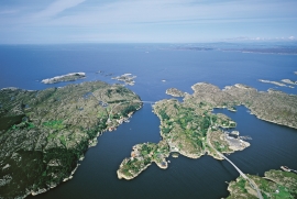
Brandasund
On Gisøya Island, on the west side of Brandasund Sound, there is a very privileged trading post and traveller's Inn from the 1600s, with the North Sea as its nearest neighbour. In 1991 a road was built over Bømlo out to these islands, but for thousands of years the sheltered harbour here was a main stopping place along the outer coast. During the great herring period of the 1700s and 1800s, Brandasund was a centre for the herring fisheries on the Sørafeltet fishing grounds. Today, the area belongs to the municipality of Bømlo.

Skånevik- moraine
In Skånevik there are marks left from the ice edge that advanced during the thousand-year cold spell (Younger Dryas) that marked the end of the Ice Age roughly 11 500 years ago. The glacier first proceeded out into Åkra Fjordand and around Vannes and thereafter sent an arm in toward Skånevik. Here, the glacier lay down an end moraine up against the mountainside.

Krokavatnet
On Sunday the 29th of January, 1989, at 17:38 o'clock, Etna shook. The earthquake, with its epicentre ca. 9 kilometres south of Etne centre, had a strength of 4.2 on the Richters scale. This could be felt over large parts of West Land, especially in the areas around Åkra, Etne, Hardanger Fjord and Sauda Fjord. The earthquake was the largest that has ever been measured in Hordaland.


Sandviksfjellet
On Sandviksfjellet there are old boulders that have been made into mountains. The stones have been stretched out or squeezed together between huge slabs of rock, during slow, but powerfulprocesses of transport. This conglomerate shows, in quite a special way, the enormous powers that were active during the collision between Norway and Greenland over 400 million years ago.


Isdalen
The valley on the inside of the Svartediks dam, a five minutes' bus ride from Bergen centre, is often referred to by Bergen folk as Isdalen ("Ice Valley") - justifiably, since the area could have been described in textbooks for its ice-carved land forms. The glacier's polishing over ca. 40 ice ages has created a magnificient landscape. The original ice valley climbs up behind Ulriken at the end of Svartediket.

