- Remove Small landforms filter Small landforms
- Remove Middle age filter Middle age
- Remove Eidfjord filter Eidfjord
- Remove Lindås, frå 2020 del av nye Alver kommune. filter Lindås, frå 2020 del av nye Alver kommune.
- Remove Modalen filter Modalen
- Remove Bømlo filter Bømlo
- Remove Tysnes filter Tysnes
- Remove Settlements, Villages, Towns filter Settlements, Villages, Towns
- Remove Farm sites filter Farm sites

Hjølmo
In the steep hillside in Hjølmodalen, a small side valley from Øvre Eidfjord (Upper Eidfjord), which has been a key entrance to the Hardanger Plateau, the hamlet of old farmhouses still lie clustered together. The yard is empty today, some of the houses are used in the summer, but the grass grows round all the corners.

Måbø
Måbø is the uppermost farm in Måbødalen. This narrow and steep mountain valley has been one of the routes from the fjord communities up to the mountain plateau from times immemorial. We are not certain of the meaning of the name Måbø. Perhaps it has its origin in an Old Norse male name Mávi, from the name for seagull, már. The last syllable “bø” means farm. Today Måbø gives us a compact close-up of the subsistence economy: the small farm with the clearance piles, stone walls and a lane that guided the animals into the yard, at the foot of the great mountain expanse.
Isdal
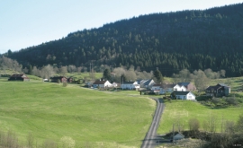
Isdal one of the few clustered settlements left in the Hordaland communities, after the extensive changes taking place around the turn of the former century, which broke up the shared farms and the old intermixture of strips. The old, low houses are situated in a compact enclosure, which is very noticeable in the landscape when you travel the main road north from Knarrvik.


Nottveit
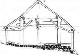
In one of the frame-built haysheds at Nottveit, at holding No. 3, we discover that several of the staves have a medieval look, with large dimensions and carefully rounded edges. According to tradition, it was the farms Nottveit and Mostraumen that supplied the timber for the stave church at Mo, and it is not unlikely that these farms received the old timber in return when the new church was erected there in 1593.

Otterstad
Tthe Otterstad farms lie in the innermost part of Mofjorden, on the northwest side of the river. The row of stave-built boatsheds that belong to the farm were probably constructed a little after the middle of the 1800s. Both here and on the Mo side, the boatsheds were important storage places at the seashore; wood and other farm products intended for the town; corn and merchandise in return.

Færavåg
The main house at Færavåg was built in 1599. History tells us that a German came to Færavåg and built the house. He divided the land between his two sons. They in turn divided it between their two sons, thus there were four equal holdings on the farm. And it is said that all households lived in the same house. They each stayed in their own corner around the fire in the middle of the floor.

Nedrevåge
Vågsbygdo was severely hit by landslides and rock falls in the decades around 1700, in addition, the rivers transported masses of loose sediment, both large stones and gravel. A lot of what slid down from the Vågsliene (slopes at Våg) collected in Neravåge. It was so bad that the damage “never again can be remedied or restored”, it was said in 1670.