- Remove Small landforms filter Small landforms
- Remove Middle age filter Middle age
- Remove Eidfjord filter Eidfjord
- Remove Stord filter Stord
- Remove Modalen filter Modalen
- Remove Igneous rocks filter Igneous rocks
- Remove Currents and tides filter Currents and tides
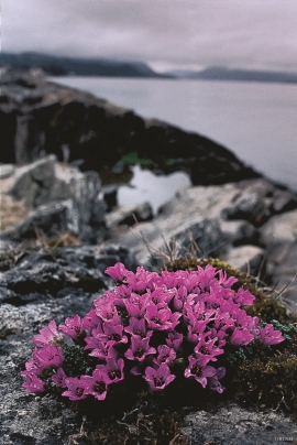
- Remove Plants by the sea filter Plants by the sea
- Remove Masfjorden filter Masfjorden
- Remove Sawmills filter Sawmills

Halne
At Halnefjorden, a few hundred metres east of Halne mountain lodge, lie the remains of two stone sheds – Halnelægeret. Some generations ago the cattle drovers stopped here in the summer; they were the cowboys of their time. But Halnelægeret already had a long history before the cattle drovers came.

Matrehola
On a large gravel terrace in Matredalen (the Matre valley), a couple of kilometres from the coastal settlement Matre, lies Storseterhilleren, at the end of a large stone block that came rushing down from the mountain. The Matre river runs just over 100 metres to the east of the cave.

Mollandseid
In Mollandsvågen, close by the river that runs from Mollandsvatnet (lake) into the fjord, are two water-powered circular saws and a mill. This small industrial centre has belonged to the farms Molland, Reknes and Duesund, which together own the rights to the waterfall


Mostraumen
Until 1743 the people from Modal had to wait for a flood in MOSTRAUMEN before they could draw their boats up the river current, and then row back across Lake Movatnet. But, that year the flood opened a free passageway all the way to Mo. Hordaland had gained a new tidal waterway.

Nottveit
In one of the frame-built haysheds at Nottveit, at holding No. 3, we discover that several of the staves have a medieval look, with large dimensions and carefully rounded edges. According to tradition, it was the farms Nottveit and Mostraumen that supplied the timber for the stave church at Mo, and it is not unlikely that these farms received the old timber in return when the new church was erected there in 1593.

Kattnakken–Stovegolvet
The highest mountainous area on Stord, including Kattnakken, Midtfjellet and Stovegolvet, has more in common with the mountainous terrain on the mainland than in the low coastal landscape of Sunnhordland. The volcanic bedrock together with the erosive powers of nature has resulted in a unique plateau landscape.

Sagvåg
The pit saw on the property of the farm Valvatna, is the origin of the name Sagvåg. The sawmill is mentioned as early as 1564. The name of the place at that time was Fuglesalt, but soon there is only talk of Saugvog.

