- Remove Boats and seafaring filter Boats and seafaring
- Remove Vernacular crafts filter Vernacular crafts
- Remove Thrust sheets filter Thrust sheets
- Remove Coniferous forests filter Coniferous forests
- Remove Masfjorden filter Masfjorden
- Remove Lindås, frå 2020 del av nye Alver kommune. filter Lindås, frå 2020 del av nye Alver kommune.
- Remove Kvam filter Kvam
- Remove Voss, frå 2020 del av nye Voss herad. filter Voss, frå 2020 del av nye Voss herad.

Spjutøy
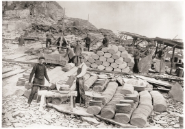
At Spjutøy and Straumsosen there are three entrances from Lurefjorden to the fjord basin inside. Right up the end of the 1800s the ferry could not reach further than to Mølna at Spjutøy. At Skallestraumen there was a bark mill driven by the powerful tidal current in the sound. Here was also a store, a bakery and a hostelry place around the middle of the 1800s.


Evanger
Evanger (from Old Norse ålvangr, “vang”, “voll” (field) where the horses may graze) is the place where the river from Vangsvatnet, the Voss watercourse, runs out into Evangervatnet. From here Teigdalen valley runs to the north, towards Eksingedalen, and from here there is a short distance to Bergsdalen in the south.


Hamlagrø
The type of underlying rock can be decisive for how many different types of plants are found in an area. In the area around Hamlagrø-lake the diversity is especially obvious. The geological conditions change much here within a short distance.

Nordheim
"And here these endless kingdoms and these toils for a rich working life far and wide have lain and slept for a hundred thousand years! Right up until the Voss Railway came in 1883 and woke them, like the prince in the fairytale who awakened the Sleeping Beauty."

Kvamskogen
The different bedrock types that got shoved in over Hordaland in Cambro-Silurian times still remain, layer by layer, almost like a cake. But at Kvamskogen the cake has been turned upside down.

Vesoldo
Folds are to be found everywhere in the remains of the Caledonian mountain chain. Some were formed during the collision with Greenland, others stem from the time when the mountain chain collapsed. Few can compare with the giant fold that remains in the mountain area around Tørvikenuten, Vesoldo and Hellefjellet.

