- Remove Large landforms filter Large landforms
- Remove Askøy filter Askøy
- Remove Fitjar filter Fitjar
- Remove Lakes, rivers and river networks filter Lakes, rivers and river networks
- Remove Pollution and environment filter Pollution and environment
Kollevågen
From 1938 until 1975 there was a large amount of trash dumped in Kollevågen. A lot of the garbage from the city of Bergen ended up here. The dump was up to 20 metres high, and much got dumped under water in the bay. When the dump was closed, the time had come to make good on a municipal promise to make the place into a recreation area. In 1978, nets and earth were laid over the dump, and afterward it was sowed with seeds. This was quite successful, and In 1983, the recreation area was opened.


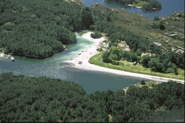
Fitjarøyane
If we study the group of islands south of Selbjørns Fjord from the air or on a sea map, we will notice that many of the islands are elongated and lie systematically in rows. The islands are divided by long sounds, for example Trollosen, Nuleia and Hjelmosen, which are oriented in a south-southeast to north-northwesterly direction.


