- Remove Small landforms filter Small landforms
- Remove Bergen filter Bergen
- Remove Middle age filter Middle age
- Remove Eidfjord filter Eidfjord
- Remove Large landforms filter Large landforms
- Remove Tysnes filter Tysnes
- Remove Ulvik filter Ulvik
- Remove Place filter Place
- Remove Deciduous forests filter Deciduous forests
- Remove Late glacial filter Late glacial
- Remove Quarns and mills filter Quarns and mills

Arnatveit
On the farm of Arnatveit, high up on the slope above the highway, an old smokehouse remains standing in the courtyard of the main farm property, in the place of the old common courtyard. Today this farm lies at the outskirts of a large housing estate. Most of the farmland of the other farm properties has been sold to benefit the city’s need of sites for the new community of Arna.

Bryggen
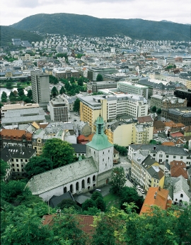
In the 1300s Bergen was a trading centre of European dimension. The town is thought to have had around 7000 inhabitants and was the largest and most important in the country. In a European context it was an average size town. At this time the most tightly built town area was still mostly east of Vågen from Holmen in the north to Vågsbotn in the south. Already in medieval times, latest in the 1340s, this area was called Bryggen.
Mariakirken
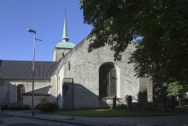
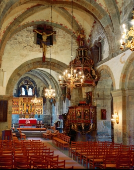
Apart from the king’s estate at Holmen, Håkonshallen and the lower floors of the Rosenkrantz tower, the three parish churches in the centre of Bergen are what have been preserved from medieval Bergen: Mariakirken, Korskirken and Olavskirken (the cathedral). The Romanesque base of the tower from Nonneseter monastery church on the spit between the two Lundegård lakes can still be seen in the landscape, while the other medieval buildings now lie in ruins: the town’s oldest town hall and wine cellar at Nikolaikirkealmenning, Lavranskirken and Maria Gildeskåle between Mariakirken and Bryggens Museum and the Katarina hospital on the north side of Dreggsalmenningen.

Sandviken
Close to the tunnel opening at Amalie Skrams vei in Ssandviken, there is a cultural monument of European dimensions; a rope making works that produced rope and fishing tackle for West and North Norway.

Vågsbunnen
Vågsbotn was the name of the innermost part of the eastern part of town from Auta-almenning (today’s Vetrlidsalmenning), skirting the bottom of Vågen to Allehelgenskirken (All Saints’ Church) (at the present Allehelgensgate). In early medieval times Vågen reached almost all the way to Olavskirken (the Cathedral). It was a relatively wide bay inside the premonitory where Korskirken was built. The area was therefore much shorter than what is known as Vågsbunnen today.


