
Rimbareid- Vestbøstad
At nesting time you cannot avoid hearing the calls of the curlew or the snipe along the narrow road through the cultural landscape from Rimbareid to Vestbøstad. And on late summer evenings, the intense song of the sedge warbler rings out over the two characteristic tarns in the area.
Dalskarvatnet–Dyvikvågen
Many of the fossils one finds on Stord are related to fossils of the same age found in North America. Scientists thinks this indicates that the bedrock on Stord was much nearer to America at that time than today.
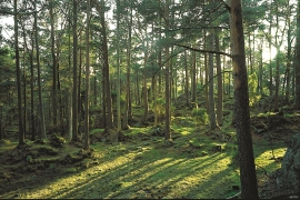
Digernes
Despite the fact that the animal life on Stord is better investigated and studied than most other places in Hordaland, we were not clear about the diversity in Digernes forest until the triple junction was almost finished being planned.


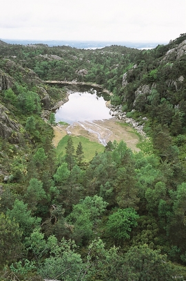
Kattnakken–Stovegolvet
The highest mountainous area on Stord, including Kattnakken, Midtfjellet and Stovegolvet, has more in common with the mountainous terrain on the mainland than in the low coastal landscape of Sunnhordland. The volcanic bedrock together with the erosive powers of nature has resulted in a unique plateau landscape.
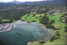
Sævarhagsvikjo
Most of the shoreline toward the sea in Sunnhordland is stony and steep. Therefore, flat tidal areas are scarce, yet these are especially important for the wading birds when they need food and rest during their autumn migrations. Sævarhagsvikjo is the biggest flat tidal area in Sunnhordland.

Espevik
220 million years ago, glowing hot molten rock masses intruded into fractures in the earth's crust in the outer parts of Hordaland. Some of these are believed to have reached the surface and formed lava flows, which since have been eroded away by wind and weather. But, most of these flows solidified into diabase sills before they got to the surface.


Fluøyane
The richest seabird localities in Bjørna Fjord are FLUØYANE, a group of small and medium-sized islets just east of the entrance to Våge. Here, we see many different nesting birds, but there is the danger that overgrowth will become an obstacle for nesting here in the future. On one of the islands, the environmental protection authority has promised to step in and help the birds.

