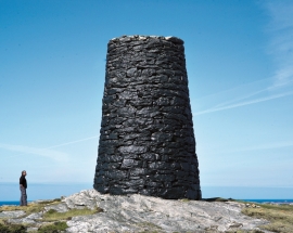
- Remove Boats and seafaring filter Boats and seafaring
- Remove Late glacial filter Late glacial
- Remove Sedimentary rocks filter Sedimentary rocks
- Remove Kvinnherad filter Kvinnherad
- Remove Fjell, frå 2020 del av nye Øygarden kommune filter Fjell, frå 2020 del av nye Øygarden kommune
- Remove Boat- and shipyards filter Boat- and shipyards
- Remove Literature filter Literature
- Remove Thrust sheets filter Thrust sheets
- Remove Austevoll filter Austevoll

Ølve
Ølve has a special soil type. Here one finds an extra hard clay soil. This is especially noticed by those who work with excavating for building foundations and the like. Often it is necessary to use especially big digging machines and sometimes even dynamite in order to break up the compact masses. The reason for this is the growth of the glaciers toward the end of the Ice Age: The clay, that was first deposited in front of the glacier, came under great pressure when the glacier later grew and slid out over the clay.

Ølve- Mining
All in all there are ten known copper mines and two iron mines on the Ølve peninsula. Geologically, the nine mines on Varaldsøy Island also should be figured in. The industry began at Lilledal in 1642 wth the mining of iron ore. From Jernsmauget by Dyråsen, the iron ore was sent to the iron works in eastern Norway.

Vatlestraumen
There are coal bits hidden in the sand under Vatlestraumen. These remains from a geological layer from the Jurassic Period were discovered when the undersea Bjorøy Tunnel was built in 1994. Oil- and gas reservoirs in the Troll Field in the sea west of Hordaland are from the same time. It is, nonetheless, quite surprising to find bedrock from dinosaur time inside of the outer islands of western Norway. On the Scandinavian mainland north of Denmark, there are only a very few places where one f inds rock from this time in earth history.
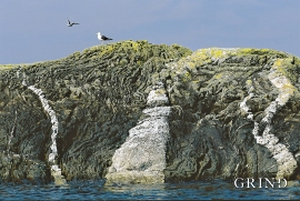
Møkstrafjordøyane
The sea keeps the bedrock in the outer skerries smooth and clean. When the bedrock is also varied and interesting, the setting is perfect for a discovery tour of these bare-faced outcrops.

Melderskin
MELDERSKIN - ONCE A NUNATAK? Melderskin, the towering and majestic landmark at Rosendal, rises 1462 metres above sea level. The top area is smooth, but slightly inclined. Geologists think that the area is a remnant of a weakly undulating landscape, that originated near the sea, long before the Ice Age set in.

