- Remove Smallholdings filter Smallholdings
- Remove Churches filter Churches
- Remove Sediments filter Sediments
- Remove Large landforms filter Large landforms
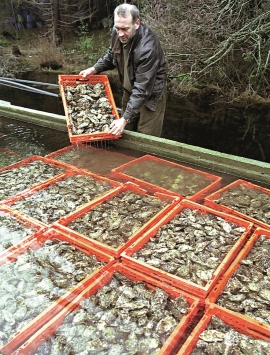
- Remove Fisheries filter Fisheries
- Remove Factories filter Factories

Kattnakken–Stovegolvet
The highest mountainous area on Stord, including Kattnakken, Midtfjellet and Stovegolvet, has more in common with the mountainous terrain on the mainland than in the low coastal landscape of Sunnhordland. The volcanic bedrock together with the erosive powers of nature has resulted in a unique plateau landscape.


Hamlagrø
The type of underlying rock can be decisive for how many different types of plants are found in an area. In the area around Hamlagrø-lake the diversity is especially obvious. The geological conditions change much here within a short distance.
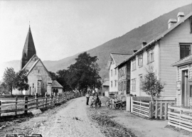
Vangskyrkja
Vangskyrkja (Vangen church) is the largest of the medieval churches in Hordaland; one of the four “fjordung” churches in the county. A royal letter from 1271 shows that the church was under construction at this time. Vossevangen at Vangsvatnet, where the wide and expansive valleys of the Voss communities meet, was the natural location for a church.


Tokagjelet
There is a sharp transition between the wide valley at Kvamskogen and the narrow Tokagjelet. The transition is no less dramatic when we come out of the crooked tunnels far down in the canyon, and the open Steinsdalen valley spreads out before us. The canyon both separates and joins together different epochs in western Norway's history.

Vikøy
Through Adolph Tidemand’s detailed close-ups of smokehouses in Kvam, the vicarage in Vikøy, where he lived during his painting trips through Hardanger, has obtained a central position in the Norwegian national romanticism.

