- Remove Small landforms filter Small landforms
- Remove Middle age filter Middle age
- Remove People and Society filter People and Society
- Remove Defense filter Defense
- Remove Dialects and arts filter Dialects and arts
- Remove Churches filter Churches
- Remove Landscape filter Landscape
- Remove Sediments filter Sediments
- Remove Potholes filter Potholes
- Remove Mountain plants filter Mountain plants
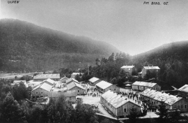


Ulvik-village
The ice cap that covered the land during each of the 40 past ice ages over the past 2 million years of Earth's history pressed down the crust of the earth - like a finger on a rubber ball. And when the ice finally loosened its grip 11,000 years ago, the earth's crust rose again, most where the ice was thickest, least where it was thin, quickly in the beginning, and later more slowly. To this day, the land in the inner part of Norway continues to rise by perhaps one millimetre per year. By and large, however, the crust in Hordaland has again reached equilibrium after the weight of the ice was removed.

Vesoldo
Folds are to be found everywhere in the remains of the Caledonian mountain chain. Some were formed during the collision with Greenland, others stem from the time when the mountain chain collapsed. Few can compare with the giant fold that remains in the mountain area around Tørvikenuten, Vesoldo and Hellefjellet.


Vinnesleira
Bays that are shallow far out into the sea, with fine sand and clay, are rare in Hordaland. Where they are found, the reason is usually that the edge of the glacier made smaller advances or stopovers when it calved back at the end of the last Ice Age. This is what happened at Vinnesleira.

Ølve
Ølve has a special soil type. Here one finds an extra hard clay soil. This is especially noticed by those who work with excavating for building foundations and the like. Often it is necessary to use especially big digging machines and sometimes even dynamite in order to break up the compact masses. The reason for this is the growth of the glaciers toward the end of the Ice Age: The clay, that was first deposited in front of the glacier, came under great pressure when the glacier later grew and slid out over the clay.
Pages
- « first
- ‹ previous
- 1
- 2
- 3
- 4

