- Remove Smallholdings filter Smallholdings
- Remove Igneous rocks filter Igneous rocks
- Remove Defense filter Defense
- Remove Cultural landscapes filter Cultural landscapes
- Remove Hydro power filter Hydro power
- Remove Fitjar filter Fitjar
- Remove Bømlo filter Bømlo
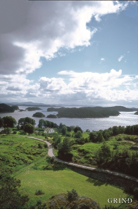
- Remove Vaksdal filter Vaksdal

Dale power station
In 1923 Bergenshalvøens Kommunale Kraftselskap (BKK) expropriated large areas for power plants and development of hydropower started soon afterwards. Dale power station with the two first aggregates, each of 14 MW was put into operation on 17 November 1927. In the supply reservoir in Storefossen 5152 cubic metres of concrete were cast, and a modern and well-equipped power station was built.

Eksingedalen- hydropower development
Water discharge at the outlet of the Ekso into Eidsfjord was halved after the big hydropower development in the mountainous area between Modalen and Eksingedalen and further southward toward Evanger in the 1960s, 70s and 80s. In an attempt to amend the changed environmental conditions in the waterway the developer built 35 small dams in the river.


Siggjo
Siggjo is a cone-shaped, volcano-like mountaintop in the part of Hordaland where one finds the best preserved volcanic rocks. The rock types originate from one or several volcanoes that spewed out glowing lava and ash. But, the shape of the mountain, as it appears today, formed later and by completely different forces.

Urangsvågen-Rubbestadneset
In 1868 the first stone workers came to Rubbestadneset to take out the granite for the Skoltegrunns Pier, predecessor of the Skoltegrunns wharf in Bergen. Later granite was also taken out from the area, around Innværs Fjord and UransvågenN. The activity probably peaked around 1900, with over 40 men at work. 15 years later, it was finished.

Fitjarøyane
If we study the group of islands south of Selbjørns Fjord from the air or on a sea map, we will notice that many of the islands are elongated and lie systematically in rows. The islands are divided by long sounds, for example Trollosen, Nuleia and Hjelmosen, which are oriented in a south-southeast to north-northwesterly direction.
Finnås
At Flintaneset by Finnåsvika, in the centre of the municipality, we find the most beautiful and best preserved igneous rocks in western Norway. We must go to Hawaii or Island to find as fine structures as at Bømlo.

