- Remove Smallholdings filter Smallholdings
- Remove Lakes, rivers and river networks filter Lakes, rivers and river networks
- Remove Sedimentary rocks filter Sedimentary rocks
- Remove Granvin, frå 2020 del av nye Voss herad filter Granvin, frå 2020 del av nye Voss herad
- Remove Ulvik filter Ulvik

Granvinsvassdraget
After the ice age, Granvin Fjord reached all the way up under Skjervsfjossen waterfall. Just a thousand years later, as a result of the rising of the land after the ice melted, this whole inner part of the fjord freed itself of the sea and became Granvinsvatnet lake. In spite of this rise in elevation, this waterway is still navigable for fish: Sea trout have wandered into Granvinsvatnet in more recent times and evolved to become freshwater trout. And salmon and sea trout made the journey 13 kilometres up the Storelvi river.

Solskinstjørni
Solskinstjørni in Osa, just above Haugen farm in Norddalen, is visible only now and again, seemingly always for a period of good weather. Then it disappears abruptly, but its disappearance is not connected to weather conditions.

Trail toward Kyrkjedøri
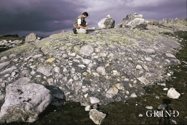
Roughly 550 million years ago, what is now Finse lay at the bottom of the sea - the remains of mud and clay that were deposited in this sea have ended up on the roofs of Norway. Also the thrust sheet from the continental collision has found its way to Finse, after a several hundred kilometre-long, trek through the mountains, that took several tens of millions of years to complete.