- Remove Small landforms filter Small landforms
- Remove Place filter Place
- Remove Sediments filter Sediments
- Remove Basement rocks filter Basement rocks
- Remove Nordhordland filter Nordhordland
- Remove Voss (tidl. kommune) filter Voss (tidl. kommune)
- Remove Thrust sheets filter Thrust sheets
- Remove Railroad filter Railroad
Stormark
Both the climate and people have been decisive in shaping the bog landscape on Fedje - a landscape that has been evolving over several thousands of years. The peat got built up layer for layer and provided income and fuel for the people of Fedje.


Eldsfjellet
The eclogites in western Norway were formed when Precambrian basement rocks were squeezed and pressed down under great pressure deep under the Caledonian mountain chain. The process may well have triggered some of the deepest earthquakes the world has ever known. The clearest traces of this drama are found in and around Mt. Eldsfjellet, in peaceful Meland.

Mostraumen
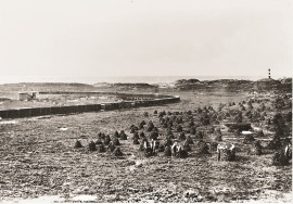
Until 1743 the people from Modal had to wait for a flood in MOSTRAUMEN before they could draw their boats up the river current, and then row back across Lake Movatnet. But, that year the flood opened a free passageway all the way to Mo. Hordaland had gained a new tidal waterway.

Nedre Helland- Sand Quarries
The three spades in the municipal coat of arms for Modalen are sand spades. Sand quarrying has brought income and employment. As much as 70,000-80,0000 tonnes of sand and gravel left the municipality each year since the turn of the millennium, to be used as cementing sand. Why is Modalen endowed with so much sand?
Litlandsvatnet
Large quantities of nickel ore have been mined from Litlandsvatnet, between Lonevågen and Hosanger. The discovery was made in 1875. During the period of operation from 1882 to 1945, 4170 tonnes of pure nickel were extracted from 462 000 tonnes of ore, a large production by Norwegian standards.

Manger
Mangerite is a rock type that was first made famous in a treatise by the Bergen geologist Carl Fredrik Kolderup in 1903. The rock type got its name from the place where it was found, and has made the Mangerud name well known around the world, at least among geologists.

Vågenes
On Vågenes, on one of the prominences out toward Eitrevågen, one finds garnets in anorthosite. The garnets are both older, and not least bigger, than average.

Bergsdalen
The mountains of western Norway are lovely to wander in. In Cambro-Silurian time it was the mountain itself that wandered. The mountain, or more correctly the bedrock, first moved eastward, then back a bit westward again. All this rocking back and forth in the mountains ended about 400 million years ago.

Eksingedalen- landscape
Eksingedalen alternates between wide, flat flood plains with good farmland, and narrow passages with waterfalls where the roads cling to the mountainsides. The alternations in the landscape are a result of the sculpturing work by glaciers over several ice ages, and the deposition of the glacial river deposits when the last glacier finally melted back.

