- Remove Small landforms filter Small landforms
- Remove Middle age filter Middle age
- Remove Maritime environments filter Maritime environments
- Remove Eidfjord filter Eidfjord
- Remove Modalen filter Modalen
- Remove Lakes, rivers and river networks filter Lakes, rivers and river networks
- Remove Bømlo filter Bømlo
- Remove Quarries filter Quarries
- Remove Sveio filter Sveio

Simadalen
On the 10th of August, 1937, over half of the agricultural land in Simadalen was submerged by the river. The damage to roads and houses was also catastrophic. This was the most destructive flood ever recorded in Hordaland.

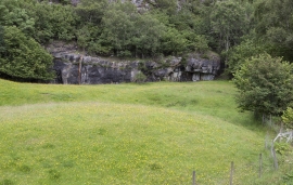
Urangsvågen-Rubbestadneset
In 1868 the first stone workers came to Rubbestadneset to take out the granite for the Skoltegrunns Pier, predecessor of the Skoltegrunns wharf in Bergen. Later granite was also taken out from the area, around Innværs Fjord and UransvågenN. The activity probably peaked around 1900, with over 40 men at work. 15 years later, it was finished.

Siggjo
Siggjo is a cone-shaped, volcano-like mountaintop in the part of Hordaland where one finds the best preserved volcanic rocks. The rock types originate from one or several volcanoes that spewed out glowing lava and ash. But, the shape of the mountain, as it appears today, formed later and by completely different forces.


Einstapevoll- slates
“On the country of Wallestrand…the rock almost everywhere appears to be of a slate-like substance, be it at the seashore, on the farms or in their distant fields”.

Bjellandsvatnet
Lake Bjellandsvatnet is one of the richest wetland areas in Sveio. But, everything has its limit, and the supply of nutrients can be too much. This is what was about to happen in Lake Bjellandsvatnet.

