- Remove Small landforms filter Small landforms
- Remove Kvinnherad filter Kvinnherad
- Remove Faults filter Faults
- Remove Large landforms filter Large landforms
- Remove Boat- and shipyards filter Boat- and shipyards
- Remove Fjell, frå 2020 del av nye Øygarden kommune filter Fjell, frå 2020 del av nye Øygarden kommune

Bondhusdalen
The Bondhus area in Maruanger has been a magnet for tourists ever since the stream of tourists to Norway's west coast began in the middle of the 1800s. The magnificent landscape with the "ice trail" up to Bondhusvatnet Lake, the ice falls from Bondhusbreen glacier and Keisarstigen trail up to Folgefonna are still popular tourist attractions.


Skorpo
Skorpo - Polished by glaciers and meltwater
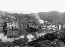
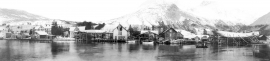
Sunde
In 1852 Haktor Thorsen erected two large warehouses on one of his farms in Sunde and started trading and salting herring. This was the start of an industrial adventure that made Sunde into one of the first industrial communities in Kvinnherad.

Ulvanosa
Some mountains have rounded shapes, while others have steep slopes and sharp edges. Ulvanosa (1246 mos.) has both. The forms reflect the type of bedrock below, and the forces that were in effect when they were formed.


Haganes
The gneiss landscape west and north of Bergen viewed in profile can remind us of a saw blade of the kind that has long, slanted sides that get broken off shorter transverse sides. It has taken several hundred million years to file this saw blade, an enduring interplay between various geological processes.

Vatlestraumen
There are coal bits hidden in the sand under Vatlestraumen. These remains from a geological layer from the Jurassic Period were discovered when the undersea Bjorøy Tunnel was built in 1994. Oil- and gas reservoirs in the Troll Field in the sea west of Hordaland are from the same time. It is, nonetheless, quite surprising to find bedrock from dinosaur time inside of the outer islands of western Norway. On the Scandinavian mainland north of Denmark, there are only a very few places where one f inds rock from this time in earth history.

Melderskin
MELDERSKIN - ONCE A NUNATAK? Melderskin, the towering and majestic landmark at Rosendal, rises 1462 metres above sea level. The top area is smooth, but slightly inclined. Geologists think that the area is a remnant of a weakly undulating landscape, that originated near the sea, long before the Ice Age set in.

