- Remove Small landforms filter Small landforms
- Remove Wetland filter Wetland
- Remove Igneous rocks filter Igneous rocks
- Remove Kvinnherad filter Kvinnherad
- Remove Maritime environments filter Maritime environments
- Remove Seabirds filter Seabirds
- Remove Monastery filter Monastery
- Remove Sund, frå 2020 del av nye Øygarden kommune filter Sund, frå 2020 del av nye Øygarden kommune
- Remove Fitjar filter Fitjar
- Remove Osterøy filter Osterøy
- Remove Mineral resources filter Mineral resources
- Remove Vaksdal filter Vaksdal
- Remove Lakes, rivers and river networks filter Lakes, rivers and river networks


Halsnøy Monastery
Halsnøy Monastery is situated in the midst of the lush fjord country in Sunnhordland, on one of the old spits, or “necks”, that has given name to the island. Gently sloping fields lead down to the sea on both sides, in the south towards the Kloster Fjord, to the north towards the sheltered Klostervågen.

Skorpo
Skorpo - Polished by glaciers and meltwater

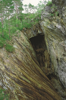
Ulvanosa
Some mountains have rounded shapes, while others have steep slopes and sharp edges. Ulvanosa (1246 mos.) has both. The forms reflect the type of bedrock below, and the forces that were in effect when they were formed.
Varaldsøy- mining
There is still a lot of ore in the abandoned mines on Varaldsøy Island. If today's prices and availability of ore continue, it is doubtful whether the mines will resume operation. But, the pyrite is there, if the market should return. On Varaldsøy Island one finds at least nine mines and prospect pits, that for the most part date back to the latter part of the 1800s.

Golta- Long house
In the years between the wars a major registration of houses and house costumes, house construction methods, fireplaces and forms of housing clusters was started in West Norway – an ambitious mapping of everything that came under the name “Registration of Culture and Geography in West Norway”. One of the places of which material was gathered in 1938 was an old multi-room house at Golta; new and interesting material for the researchers from the Historical Museum, but well known within the local building tradition through several generations.

Goltasundet
For generations the land-seine was the most important tool for catching herring and mackerel, and therefore a suitable casting bay was worth its weight in gold. Goltasundet (the Golta sound) on Golta was such a place. Here the herring often drifted in and fantastic casts might be made here.

Spildepollen
The oceanic crust of the North Sea was subjected to a lot of stretching both in Permian and Triassic times, and later in the Jurassic. This stretching resulted in the North Sea collapsing in and also to large faults forming west of Hordaland and on the mainland. Austefjorden in Sund follows one of these faults.


Herlandsnesjane
Herlandsnesjane, a four-kilometre long peninsula in Lake Storavatnet in the middle of Osterøy, is well known among botanists. Here lies an unusually large and diverse bog.

