- Remove Small landforms filter Small landforms
- Remove Kvinnherad filter Kvinnherad
- Remove Seabirds filter Seabirds
- Remove Monastery filter Monastery
- Remove Sund, frå 2020 del av nye Øygarden kommune filter Sund, frå 2020 del av nye Øygarden kommune
- Remove Fitjar filter Fitjar
- Remove Osterøy filter Osterøy
- Remove Mineral resources filter Mineral resources
- Remove Igneous rocks filter Igneous rocks
- Remove Mines filter Mines
- Remove Vaksdal filter Vaksdal


Halsnøy Monastery
Halsnøy Monastery is situated in the midst of the lush fjord country in Sunnhordland, on one of the old spits, or “necks”, that has given name to the island. Gently sloping fields lead down to the sea on both sides, in the south towards the Kloster Fjord, to the north towards the sheltered Klostervågen.

Skorpo
Skorpo - Polished by glaciers and meltwater

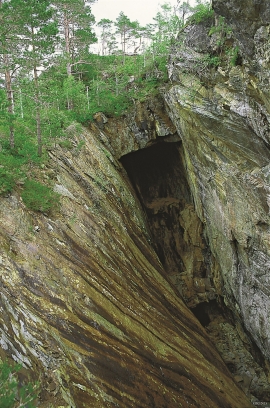
Ulvanosa
Some mountains have rounded shapes, while others have steep slopes and sharp edges. Ulvanosa (1246 mos.) has both. The forms reflect the type of bedrock below, and the forces that were in effect when they were formed.
Varaldsøy- mining
There is still a lot of ore in the abandoned mines on Varaldsøy Island. If today's prices and availability of ore continue, it is doubtful whether the mines will resume operation. But, the pyrite is there, if the market should return. On Varaldsøy Island one finds at least nine mines and prospect pits, that for the most part date back to the latter part of the 1800s.

Ølve- Mining
All in all there are ten known copper mines and two iron mines on the Ølve peninsula. Geologically, the nine mines on Varaldsøy Island also should be figured in. The industry began at Lilledal in 1642 wth the mining of iron ore. From Jernsmauget by Dyråsen, the iron ore was sent to the iron works in eastern Norway.

Spildepollen
The oceanic crust of the North Sea was subjected to a lot of stretching both in Permian and Triassic times, and later in the Jurassic. This stretching resulted in the North Sea collapsing in and also to large faults forming west of Hordaland and on the mainland. Austefjorden in Sund follows one of these faults.
Litlandsvatnet
Large quantities of nickel ore have been mined from Litlandsvatnet, between Lonevågen and Hosanger. The discovery was made in 1875. During the period of operation from 1882 to 1945, 4170 tonnes of pure nickel were extracted from 462 000 tonnes of ore, a large production by Norwegian standards.

Fitjarøyane
If we study the group of islands south of Selbjørns Fjord from the air or on a sea map, we will notice that many of the islands are elongated and lie systematically in rows. The islands are divided by long sounds, for example Trollosen, Nuleia and Hjelmosen, which are oriented in a south-southeast to north-northwesterly direction.

Grønafjellet
Mountain plants with their beautiful, colourful flowers are common in high altitude areas in Norway. On the coast there are not so many of them. But, here and there one nonetheless finds mountain plants, and this makes some coastal mountainsides a little bit different. Perhaps the growth on these mountainsides gives us a little glimpse of a distant past?

