- Remove Modalen filter Modalen
- Remove Arkitektur filter Arkitektur
- Remove Masfjorden filter Masfjorden
- Remove Maritime environments filter Maritime environments
- Remove Austrheim filter Austrheim
- Remove Nordhordland filter Nordhordland
- Remove Place filter Place
- Remove Vaksdal filter Vaksdal
- Remove Civil servant dwellings and manors filter Civil servant dwellings and manors
- Remove Large landforms filter Large landforms
- Remove Currents and tides filter Currents and tides
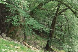
- Remove Deciduous forests filter Deciduous forests

Bergsdalen
The mountains of western Norway are lovely to wander in. In Cambro-Silurian time it was the mountain itself that wandered. The mountain, or more correctly the bedrock, first moved eastward, then back a bit westward again. All this rocking back and forth in the mountains ended about 400 million years ago.

Dyrdal
If you journey along Austfjorden, you at the same time turn the pages of time back through Ice Age history. The landforms show how the landscape has developed gradually as the glaciers have grown - and melted again - in several episodes: from small cirques, we see innermost at Dyrdal, to larger fjords, like at Mas fjord further out.

Eksingedalen- landscape
Eksingedalen alternates between wide, flat flood plains with good farmland, and narrow passages with waterfalls where the roads cling to the mountainsides. The alternations in the landscape are a result of the sculpturing work by glaciers over several ice ages, and the deposition of the glacial river deposits when the last glacier finally melted back.

Krossøy
Furthest north in the island community Rongevær, at the entrance to Fensfjorden, lies Krossøy. Belonging to the farm are the islands of Krossøy, Husøy, Kårøy, Lyngkjerringa, Søre Kjerringa, Rotøy and Kuhovet. All of them have been inhabited. On Krossøy itself today there are four holdings. The marine use environment here is one of the best preserved along the West Norwegian coast.


Mostraumen
Until 1743 the people from Modal had to wait for a flood in MOSTRAUMEN before they could draw their boats up the river current, and then row back across Lake Movatnet. But, that year the flood opened a free passageway all the way to Mo. Hordaland had gained a new tidal waterway.

Otterstad
Tthe Otterstad farms lie in the innermost part of Mofjorden, on the northwest side of the river. The row of stave-built boatsheds that belong to the farm were probably constructed a little after the middle of the 1800s. Both here and on the Mo side, the boatsheds were important storage places at the seashore; wood and other farm products intended for the town; corn and merchandise in return.


