- Remove Small landforms filter Small landforms
- Remove Kvinnherad filter Kvinnherad
- Remove Boats and seafaring filter Boats and seafaring
- Remove Lindås, frå 2020 del av nye Alver kommune. filter Lindås, frå 2020 del av nye Alver kommune.
- Remove Burial mounds filter Burial mounds
- Remove Late glacial filter Late glacial

Bondhusdalen
The Bondhus area in Maruanger has been a magnet for tourists ever since the stream of tourists to Norway's west coast began in the middle of the 1800s. The magnificent landscape with the "ice trail" up to Bondhusvatnet Lake, the ice falls from Bondhusbreen glacier and Keisarstigen trail up to Folgefonna are still popular tourist attractions.


Halsnøy
Hadde ikkje Hardangerfjordbreen mot slutten av istida rykt fram over fjordbotnen, ville Halsnøy ikkje eksistert som éi øy, men som mange småøyar. Breen skuva framfor seg så mykje leire frå havbotnen at Brattåsen, Toftåsen, Landåsen og Svartaberg vart samla i eitt landområde.


Melderskin
MELDERSKIN - ONCE A NUNATAK? Melderskin, the towering and majestic landmark at Rosendal, rises 1462 metres above sea level. The top area is smooth, but slightly inclined. Geologists think that the area is a remnant of a weakly undulating landscape, that originated near the sea, long before the Ice Age set in.

Seim
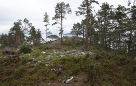
Sæheim (Seim) at Lygrefjord is mentioned as one of the royal farms of Harald Hårfagre. Several of the first Norwegian national kings had their seat here, and the farm became Crown Property up to the 1400s. According to the sagas, Håkon den gode is buried on the farm.

Skorpo
Skorpo - Polished by glaciers and meltwater

Spjutøy
At Spjutøy and Straumsosen there are three entrances from Lurefjorden to the fjord basin inside. Right up the end of the 1800s the ferry could not reach further than to Mølna at Spjutøy. At Skallestraumen there was a bark mill driven by the powerful tidal current in the sound. Here was also a store, a bakery and a hostelry place around the middle of the 1800s.