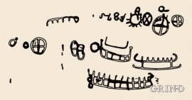
64 results
- Remove Quarns and mills filter Quarns and mills
- Remove Iron age filter Iron age
- Remove Bronze age filter Bronze age
- Remove Place filter Place
- Remove Plants by the sea filter Plants by the sea
- Remove Faults filter Faults
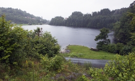

Krokavatnet
06.03.2019 - 15:07
On Sunday the 29th of January, 1989, at 17:38 o'clock, Etna shook. The earthquake, with its epicentre ca. 9 kilometres south of Etne centre, had a strength of 4.2 on the Richters scale. This could be felt over large parts of West Land, especially in the areas around Åkra, Etne, Hardanger Fjord and Sauda Fjord. The earthquake was the largest that has ever been measured in Hordaland.
Last changed: 06.03.2019 | Content type: Place