- Remove Museum filter Museum
- Remove Vernacular arts filter Vernacular arts
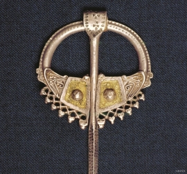
- Remove Iron age filter Iron age
- Remove Defense filter Defense
- Remove Farm sites filter Farm sites
- Remove Coniferous forests filter Coniferous forests
- Remove Late glacial filter Late glacial
- Remove Vegetation history filter Vegetation history
Sæbøtunet
When you come into the well-tended farm steading at Sæbø just above Etne centre, you get the impression of a Sunnhordland farm from well before the time of the tractor; from the time of the horse and the scythe. The hamlet at Sæbø, one of the farms neighbouring to Gjerde, was taken over by Sunnhordland Folk Museum in 1938.

Ringheim
The farm Ringheim by Lundarvatnet is amongst the largest in Voss. It is divided into eight units and four cadastral numbers: Store Ringheim, Indre Ringheim, Nedre Ringheim and Vetle Ringheim. The farm Lund, from which Lundarvatnet takes its name, must have been a part of Ringheim, and the farms Gjerde and Tròdo (Trå) must formerly have been separated from Ringheim. The name Ringheim indicates that it stems from early times.

Øvre Folkedal
Folkedal, which today is like a small “detour” from the main highway, was in the Middle Ages centrally situated in one of the most important roads between Hardanger and Voss. This is the road that Olav Haraldsson travelled in 1023, when he came from the royal farm at Avaldsnes for a meeting with the Voss inhabitants about the new belief. The road passes across the mountain pasture Krossaset and down Bordalen to Vangen.
Hufthammar
Farming in Austevoll has nearly all been in combination with fishing as the main industry. The farms in the district are therefore small, even in a west Norwegian context.

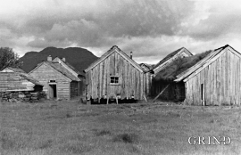
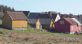
Havrå
In the sunny, steep fjord landscape along Sørfjorden on the east side of Osterøy is the farm Havrå. The small “hamlet” is one of the few undisturbed farming communities that gives us the impression of the large communal yards in West Norway in the 1700s, with houses built close together and strips of arable land.

Bondhusdalen
The Bondhus area in Maruanger has been a magnet for tourists ever since the stream of tourists to Norway's west coast began in the middle of the 1800s. The magnificent landscape with the "ice trail" up to Bondhusvatnet Lake, the ice falls from Bondhusbreen glacier and Keisarstigen trail up to Folgefonna are still popular tourist attractions.

Halsnøy
Hadde ikkje Hardangerfjordbreen mot slutten av istida rykt fram over fjordbotnen, ville Halsnøy ikkje eksistert som éi øy, men som mange småøyar. Breen skuva framfor seg så mykje leire frå havbotnen at Brattåsen, Toftåsen, Landåsen og Svartaberg vart samla i eitt landområde.