- Remove Precipitation filter Precipitation
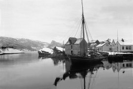
- Remove Trading posts and guesthouses filter Trading posts and guesthouses
- Remove Large landforms filter Large landforms
- Remove Waterfalls filter Waterfalls
- Remove Sedimentary rocks filter Sedimentary rocks
- Remove Wetland filter Wetland

Bondhusdalen
The Bondhus area in Maruanger has been a magnet for tourists ever since the stream of tourists to Norway's west coast began in the middle of the 1800s. The magnificent landscape with the "ice trail" up to Bondhusvatnet Lake, the ice falls from Bondhusbreen glacier and Keisarstigen trail up to Folgefonna are still popular tourist attractions.

Ulvanosa
Some mountains have rounded shapes, while others have steep slopes and sharp edges. Ulvanosa (1246 mos.) has both. The forms reflect the type of bedrock below, and the forces that were in effect when they were formed.

Bergen- Rain City
"With its strange situation (surrounded by high mountains), this city has the advantage of a beautiful port and considerable shipping, but also the disadvantage that once on land one cannot get to the city without great inconvenience. This is because the weather in the vicinity of these high mountains is extremely unpleasant and rainy. There has even evolved an expression that is always rains in Bergen, and we have not experienced anything to counteract this saying." (a quote by the Dutch professor Fabricius after a visit to Bergen in ca. 1780).

Kalandsvika
There is little to say about the opportunity for surveying from the bird observation tower in Kalandsvika: 155 different bird species have been sighted in the Kalands water shed. Take your binoculars and visit the tower in late spring - early summer or during the winter half of the year. If you are lucky, you might get to see a rare bird species.

Reppadalen
The unusual bog landscape, with enormous peat deposits surrounded by steep mountainsides, makes Reppadalen in Arna an exciting, but little visited tour destination for most of Bergen's inhabitants. Those who live in Arna, however, know to make the most of its beautiful natural splendour.

Salhus
Salhus has been a connecting point for sea travellers far back in time. The name probably derives from the Old Norse word sáluhús, “house for travellers”. The name may indicate that this was a place for an inn even in the Middle Ages. The place is eminently situated in the route to and from Bergen. For travellers coming by boat from Sogn and Nordhordland, Salhus is the last stop before Bergen. Travellers from the communities in Voss also came this way earlier when they were going to Bergen


Åsane
Most associate Åsane with ridges, naturally enough (the Norwegian word for "ridge" is "Ås"). A lesser noticed trait in the landscape are the unusual flat areas that lie between the ridges. The Dalselva River, which was channeled at the end of the 1950s, runs down only 2.5 metres from Lake Langavatnet by Vågsbotn to Flatevad, where it goes over into rapids by Fossekleiva. The layers of gneiss stand nearly vertically, and the mountain surface is so even that one might think it had been planed with a planer.
Bakholmen
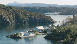
On Austre Bakholmen, a small islet of around 15 acres between Hundvåko and Drøni, lies the oldest trading centres in Austevoll. For a long time this was a court location and it was a natural centre in this archipelago.

