- Remove Smallholdings filter Smallholdings
- Remove Avalanches and rock falls filter Avalanches and rock falls
- Remove Churches filter Churches
- Remove Eidfjord filter Eidfjord
- Remove Late glacial filter Late glacial
- Remove Bergen filter Bergen
- Remove Modalen filter Modalen
- Remove Samnanger filter Samnanger
- Remove Sediments filter Sediments
- Remove Large landforms filter Large landforms

Fjøsanger
Fjøsanger is known among ice age researchers from around the world. Under an excavation in 1975-77, geologists from the University of Bergen found layers from the last interglacial, ca. 115 000 to 130 000 years old.
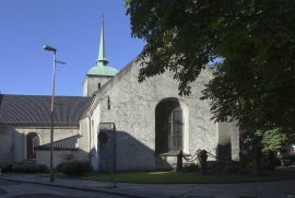
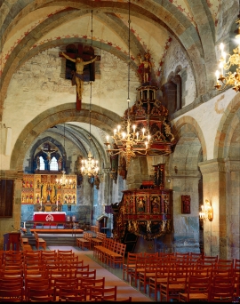
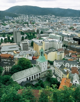
Mariakirken
Apart from the king’s estate at Holmen, Håkonshallen and the lower floors of the Rosenkrantz tower, the three parish churches in the centre of Bergen are what have been preserved from medieval Bergen: Mariakirken, Korskirken and Olavskirken (the cathedral). The Romanesque base of the tower from Nonneseter monastery church on the spit between the two Lundegård lakes can still be seen in the landscape, while the other medieval buildings now lie in ruins: the town’s oldest town hall and wine cellar at Nikolaikirkealmenning, Lavranskirken and Maria Gildeskåle between Mariakirken and Bryggens Museum and the Katarina hospital on the north side of Dreggsalmenningen.


Åsane
Most associate Åsane with ridges, naturally enough (the Norwegian word for "ridge" is "Ås"). A lesser noticed trait in the landscape are the unusual flat areas that lie between the ridges. The Dalselva River, which was channeled at the end of the 1950s, runs down only 2.5 metres from Lake Langavatnet by Vågsbotn to Flatevad, where it goes over into rapids by Fossekleiva. The layers of gneiss stand nearly vertically, and the mountain surface is so even that one might think it had been planed with a planer.

Fruo
At Fruo, nature has built its own little "Chinese wall ". Some kilometers south of the Vøringsfossen waterfall, there are a number of moraine ridges, the longest and most notable of their kind in Hordaland.

Hæreid- geology
The Eidfjord terrace is a gigantic ridge that reaches up more than one hundred metres from the city centre in Eidfjord. It serves as a powerful natural monument left behind by the ice when it retreated.

