- Remove Basement rocks filter Basement rocks
- Remove Midthordland filter Midthordland
- Remove Archaeological findings filter Archaeological findings
- Remove Late glacial filter Late glacial
- Remove Benthic organisms filter Benthic organisms
- Remove Metamorphic rocks filter Metamorphic rocks
- Remove Lakes, rivers and river networks filter Lakes, rivers and river networks
- Remove Samnanger filter Samnanger

Fossen Bratte
The steep drop by Fossen cliff has been the biggest challenge for those who wished to make a road over Kvamskogen through the years. Leave the car by the monument on the old road and take a walk down to the bend by the waterfall that Bergen-folk call "The bridal veil". Why is there a waterfall just here?

Frøland
Much rain, a steep drop and nearness to Bergen meant that the power-making potential of the Samnanger water system was exploited early. Samnanger was thus one of the first power-producing municipalities in western Norway. With its subsequent expansion and new power stations, about 400 gigawatts of electricity per hour were produced on average each year. This is enough to meet the energy needs of 25,000 households.


Gullbotnen
A barren belt where almost nothing grows, runs through the forest on the east slope of Gullbotnen. But, along the west side of the main road there is a fertile zone that flourishes with several finicky plant types. The contrasts arise from the extreme variations in the nutrient content of the bedrock.

Lona
One does not need much imaginationto see that where the river bends down in Røssebotnen, there has once been a lake. The landscape tells this - more clearly than any book.
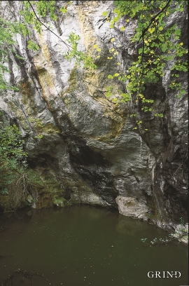
Kvernes
Håkons Hall, Domkirken Church, Bergen Børs Stock Exchange, Permanenten and other well known buildings in Bergen are decorated with soapstone from Øvre Kvernes. The quarry is a big hole in the mountainside by the cliff just east of the farm buildings.

