- Remove Small landforms filter Small landforms
- Remove Middle age filter Middle age
- Remove Maritime environments filter Maritime environments
- Remove Place filter Place
- Remove Road constructions filter Road constructions
- Remove Stord filter Stord
- Remove Large landforms filter Large landforms
- Remove Fitjar filter Fitjar
- Remove Fossils filter Fossils


Fitjarøyane
If we study the group of islands south of Selbjørns Fjord from the air or on a sea map, we will notice that many of the islands are elongated and lie systematically in rows. The islands are divided by long sounds, for example Trollosen, Nuleia and Hjelmosen, which are oriented in a south-southeast to north-northwesterly direction.


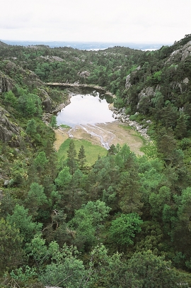
Dalskarvatnet–Dyvikvågen
Many of the fossils one finds on Stord are related to fossils of the same age found in North America. Scientists thinks this indicates that the bedrock on Stord was much nearer to America at that time than today.

Huglo
The majority of Huglo is bare rock. A bit of dwarf pine forest is the only vegetation able to put down roots. Along the west- and east sides, to the contrary, the landscape is unusually green and lush. The reason lies both in the bedrock and in the ice that covered the area 12 000 years ago.

Kattnakken–Stovegolvet
The highest mountainous area on Stord, including Kattnakken, Midtfjellet and Stovegolvet, has more in common with the mountainous terrain on the mainland than in the low coastal landscape of Sunnhordland. The volcanic bedrock together with the erosive powers of nature has resulted in a unique plateau landscape.

Ådlandsstova
The Ådland house is one of the biggest medieval houses still existing in West Norway. It is constructed from unusually large, hard fir wood, beautifully oval-cut. One story links the cottage to the Gildeskålbakken at Orninggård (Lower Ådland); thus indicating that the cottage has been the medieval banqueting hall. The building has been dated back to the 13-1400s by carbon dating.

