- Remove Small landforms filter Small landforms
- Remove Museum filter Museum
- Remove Late glacial filter Late glacial
- Remove Trading posts and guesthouses filter Trading posts and guesthouses
- Remove Hardanger og Voss filter Hardanger og Voss
- Remove Basement rocks filter Basement rocks
- Remove Waterfalls filter Waterfalls


Fruo
At Fruo, nature has built its own little "Chinese wall ". Some kilometers south of the Vøringsfossen waterfall, there are a number of moraine ridges, the longest and most notable of their kind in Hordaland.

Hæreid- geology
The Eidfjord terrace is a gigantic ridge that reaches up more than one hundred metres from the city centre in Eidfjord. It serves as a powerful natural monument left behind by the ice when it retreated.

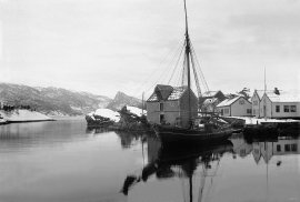
Heggjagarden
The transport exchange on the farm Vik in Eidfjord was an important part of the communication network in older times. This is where people secured transport by boat out in the fjord, those travelling across the mountain from east and down into Måbødalen. The transport exchange was situated at “Wiige grund”. Today the highway cuts through the farmyard; the main farmhouse from the 1800s lies on the upper side of the road, the large sea-house, with a bakery in former times, lies close to the fjord.


Måbødalen- geology
The old pack road had 1500 steps, where cars today gas through the mountain. The time of this hard work is over, and of getting used to the steep terrain, as well; only the view from the top is much the same as before. Vøringsfossen in summer is one of Western Norway’s biggest natural wonders. It marks the transition between the older, open part of the Sysendalen valley and the younger, narrow and winding valley of Måbødalen.


Kongstun
In the Middle Ages the farmers were under obligation to transport state officials. The bishops were entitled to 18 horses when they travelled about on visitations, and the king could requisition free transport.

