- Remove Small landforms filter Small landforms
- Remove Basement rocks filter Basement rocks
- Remove Nordhordland filter Nordhordland
- Remove Sedimentary rocks filter Sedimentary rocks
- Remove Lighthouses filter Lighthouses
- Remove Railroad filter Railroad
- Remove Mines filter Mines
- Remove Farming and forestry filter Farming and forestry

Hellisøy
Hellisøy lighthouse was lit for the first time in 1855. The characteristic red cast-iron tower with two white belts is 33m high and a light height of 46m above high tide.

Holmengrå
Holmengrå is the only place in Hordaland where we find traces of the abrasion that is supposed to have transformed Western Norway from a Himalaya-like high mountain landscape during the earth's Paleozoic Era, to a flat lowlands terrain during the Mezosoic Era. Just 400 million years ago, large and small stones plummeted down from the high mountains. Some of these stones became incorporated into the conglomerate bedrock on Holmengrå.
Stormark
Both the climate and people have been decisive in shaping the bog landscape on Fedje - a landscape that has been evolving over several thousands of years. The peat got built up layer for layer and provided income and fuel for the people of Fedje.

Lygra
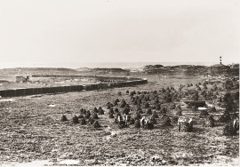
The heath landscape on outer Lygra, Utluro and Lurekalven will in future become part of a landscape protection area, to be maintained through traditional activities with year-round outdoor sheep, grazing and burning. The West Norwegian heath country belongs to a large North Atlantic coastal landscape stretching from the Bay of Biscay to the Lofoten islands.

Litlandsvatnet
Large quantities of nickel ore have been mined from Litlandsvatnet, between Lonevågen and Hosanger. The discovery was made in 1875. During the period of operation from 1882 to 1945, 4170 tonnes of pure nickel were extracted from 462 000 tonnes of ore, a large production by Norwegian standards.


