- Remove Small landforms filter Small landforms
- Remove Fisheries filter Fisheries
- Remove Late glacial filter Late glacial
- Remove Place filter Place
- Remove Igneous rocks filter Igneous rocks

Ølve
Ølve has a special soil type. Here one finds an extra hard clay soil. This is especially noticed by those who work with excavating for building foundations and the like. Often it is necessary to use especially big digging machines and sometimes even dynamite in order to break up the compact masses. The reason for this is the growth of the glaciers toward the end of the Ice Age: The clay, that was first deposited in front of the glacier, came under great pressure when the glacier later grew and slid out over the clay.

Vinnesleira
Bays that are shallow far out into the sea, with fine sand and clay, are rare in Hordaland. Where they are found, the reason is usually that the edge of the glacier made smaller advances or stopovers when it calved back at the end of the last Ice Age. This is what happened at Vinnesleira.

Urangsvågen-Rubbestadneset
In 1868 the first stone workers came to Rubbestadneset to take out the granite for the Skoltegrunns Pier, predecessor of the Skoltegrunns wharf in Bergen. Later granite was also taken out from the area, around Innværs Fjord and UransvågenN. The activity probably peaked around 1900, with over 40 men at work. 15 years later, it was finished.


Ulvanosa
Some mountains have rounded shapes, while others have steep slopes and sharp edges. Ulvanosa (1246 mos.) has both. The forms reflect the type of bedrock below, and the forces that were in effect when they were formed.

The village of Etne
Much of the sand and gravel that the town of Etne is built on was laid down at the end of the Ice Age and is evidence of melting glaciers and roaring meltwater rivers. The uncompacted material in the big terraces leave their unmistakeable mark on the wide elongated valleys.
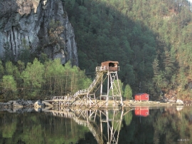
Straume- Salmon
From times immemorial salmon and trout have been caught with various tools in the fjord and the streams here. Finds in the Stone Age settlements at Skipshelleren indicate that salmon was probably caught by angling. Nets, fish pots and traps have been used in the rivers right up to our times. In the fjords the use of nets was developed into a salmon seine around 1500, and later into what today is known as fixed seine.

Spildepollen
The oceanic crust of the North Sea was subjected to a lot of stretching both in Permian and Triassic times, and later in the Jurassic. This stretching resulted in the North Sea collapsing in and also to large faults forming west of Hordaland and on the mainland. Austefjorden in Sund follows one of these faults.

Skånevik- moraine
In Skånevik there are marks left from the ice edge that advanced during the thousand-year cold spell (Younger Dryas) that marked the end of the Ice Age roughly 11 500 years ago. The glacier first proceeded out into Åkra Fjordand and around Vannes and thereafter sent an arm in toward Skånevik. Here, the glacier lay down an end moraine up against the mountainside.

Skorpo
Skorpo - Polished by glaciers and meltwater

