- Remove Small landforms filter Small landforms
- Remove Fisheries filter Fisheries
- Remove Late glacial filter Late glacial
- Remove Large landforms filter Large landforms
- Remove Bergen filter Bergen
- Remove Ulvik filter Ulvik
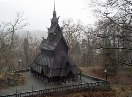
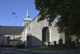
- Remove Churches filter Churches
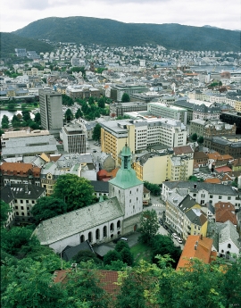
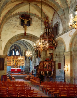
Mariakirken
Apart from the king’s estate at Holmen, Håkonshallen and the lower floors of the Rosenkrantz tower, the three parish churches in the centre of Bergen are what have been preserved from medieval Bergen: Mariakirken, Korskirken and Olavskirken (the cathedral). The Romanesque base of the tower from Nonneseter monastery church on the spit between the two Lundegård lakes can still be seen in the landscape, while the other medieval buildings now lie in ruins: the town’s oldest town hall and wine cellar at Nikolaikirkealmenning, Lavranskirken and Maria Gildeskåle between Mariakirken and Bryggens Museum and the Katarina hospital on the north side of Dreggsalmenningen.


Åsane
Most associate Åsane with ridges, naturally enough (the Norwegian word for "ridge" is "Ås"). A lesser noticed trait in the landscape are the unusual flat areas that lie between the ridges. The Dalselva River, which was channeled at the end of the 1950s, runs down only 2.5 metres from Lake Langavatnet by Vågsbotn to Flatevad, where it goes over into rapids by Fossekleiva. The layers of gneiss stand nearly vertically, and the mountain surface is so even that one might think it had been planed with a planer.

Jomfrunuten
Freezing and thawing are processes that influence plant cover, move enormous blocks, stretche long mounds of earth, break open bedrock and create patterns in stone and earth.

Rallarvegen
They rest there, all as one, the silent witnesses of Western Norway's saga of creation: Precambrian basement, phyllite and thrust sheet. In the end came the glaciers and sculptured the vast landscape. Along the ground or on the horizon, from bicycle or on foot - the landscape tells its story - and it tells it clearer on Rallarvegen than many other places.


